Snow Observations List
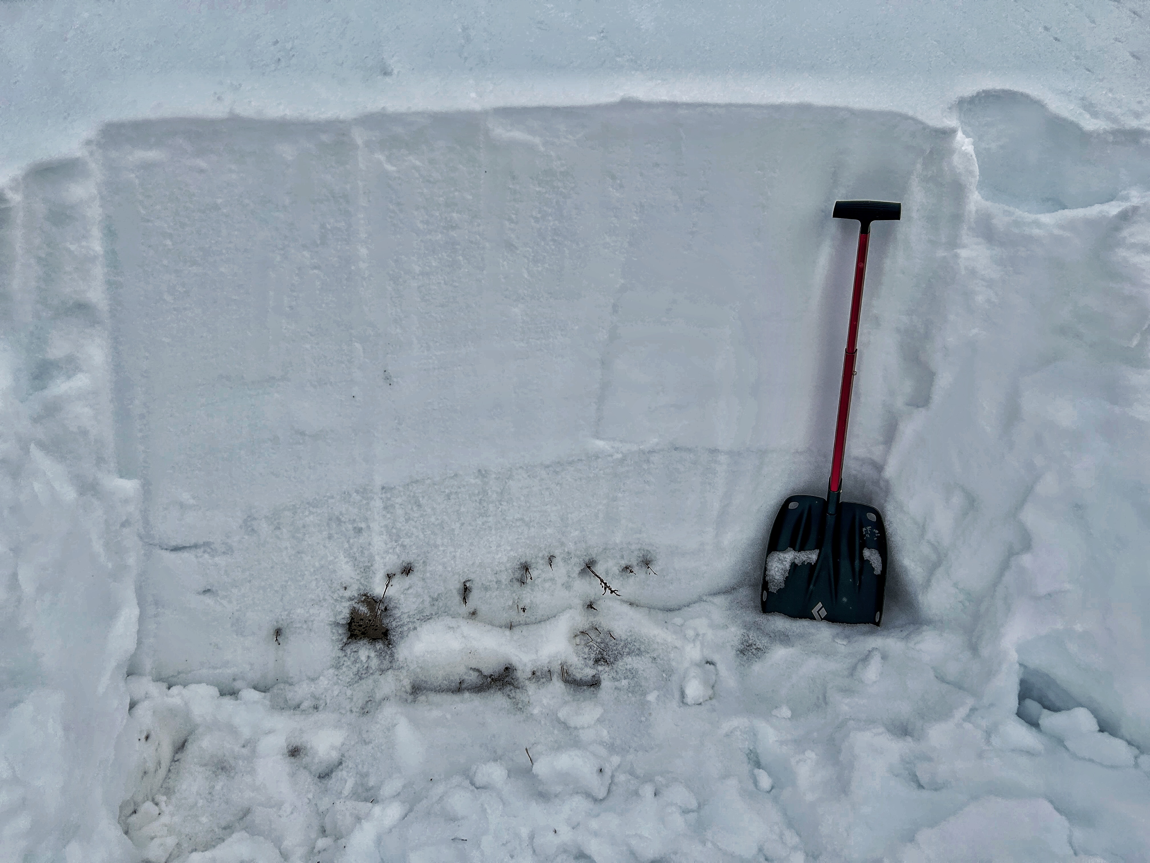
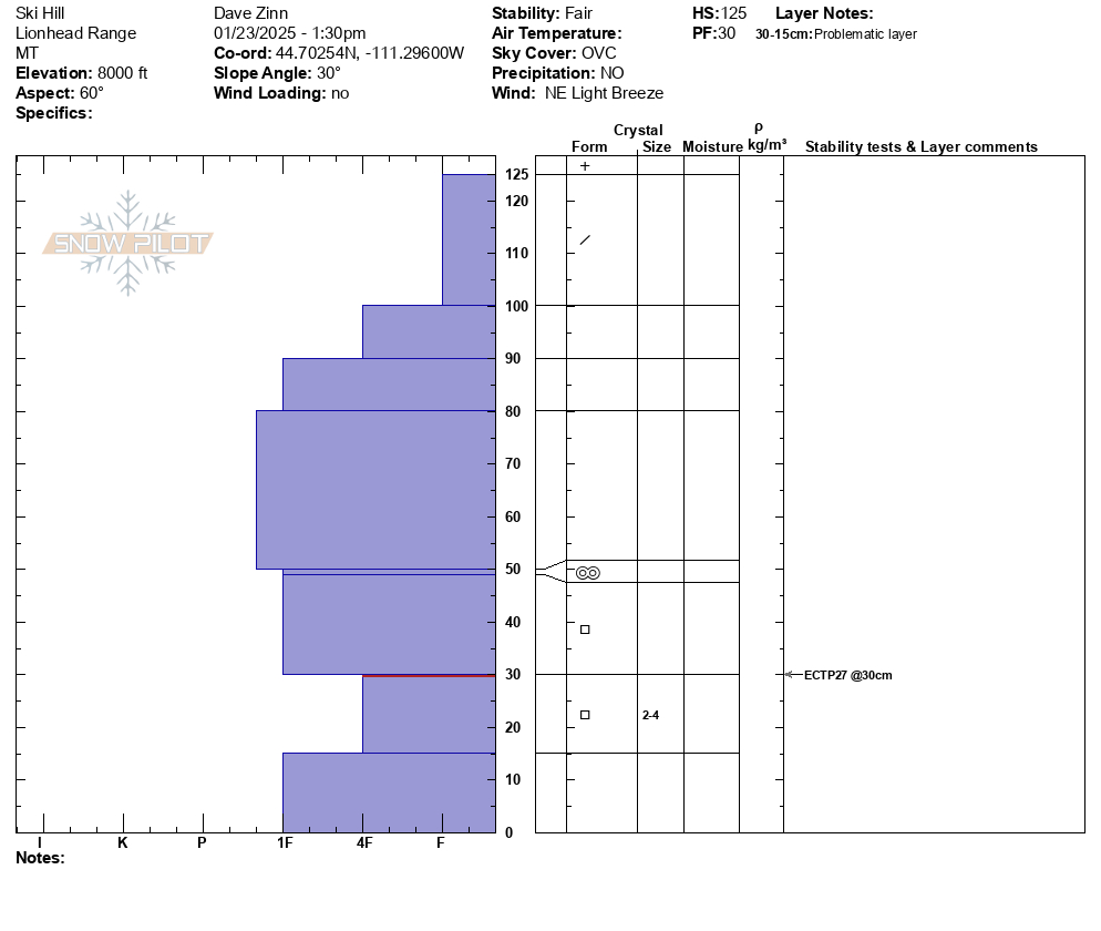
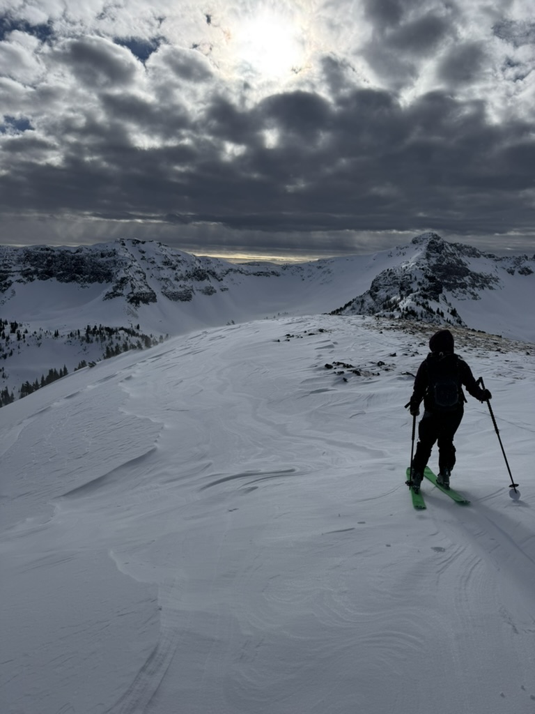
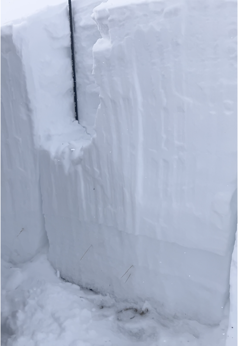
We went to Lionhead, seeking some of the thinnest and weakest snow. We found relatively thin snow - the snowpack was mostly a 1 meter deep (3.2 ft). It was supportive for sleds and you could walk on top with about 6-8 out of every 10 steps not punching through to the ground. This is because there is a very cohesive slab on top of the early December facets.
What surprised us was how stubborn that weak layer was in our tests. We dug in 4 different places on E, E, E, and NW aspects between 8000 and 9200 feet. ECTs either wouldn't even break or would propagate on the weak layer after mid- to high 20s for taps.
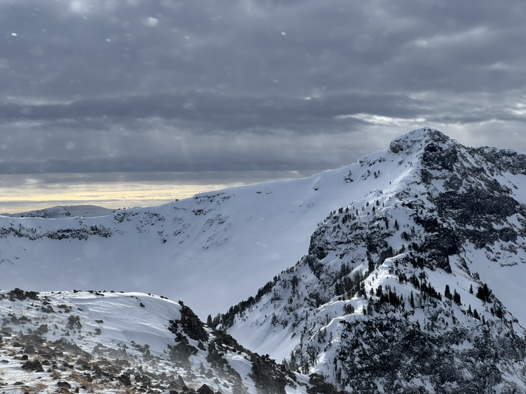
We observed some new facets near the snow surface that formed last weekend during very cold weather. On Lionhead Ridge we found these facets capped by a hard but thin (~4 inch thick) wind slab.
Summary
- The early December faceted layer seems mostly dormant for now.
- Wind slabs are the main problem and they will be extra sensitive as more snow comes Friday providing winds more ammo to make the wind slabs deeper. Because these wind slabs may be resting on facets, they could stay a problem for sometime.
- We did not get a chance to map how widespread or isolated this wind slab/facet combo is.
Full Snow Observation Report
Isolated shooting cracks and windslabs above treeline south of Cooke City today. Strong winds from the west. Lots of wind transport going on up high. The vis was good this morning and I could see far for the first time in a while. I saw no new avalanches.
Full Snow Observation ReportFrom email: "Skies were clear at 8am, but clouds rolled in quickly and we had S-1 snowfall starting at 1pm. Winds were L in the basin and L-M at ridge tops out of the W-NW. Moderate snow transport on high elevation peaks. West aspects near ridgetops were scoured, as they usually are. We found a 2-3cm thick MF crust under 5-10cm of new snow on E, W, and S aspects near ridgetops and in the basin. No cr, co.
Students dug pits on E-SE aspects at 9200', as well as on E and W aspects near the Prayer Flags. HS ranged from 100-145cm. Two of ten pits had propagation. ECTP1 on small facets above the MF crust and under a wind slab. ECTP30 on 2mm facets 30cm up from the ground. Hand pits had planar results below the MF crust where it was capped by a wind slab."
Full Snow Observation ReportI toured up to the Divide Cirque today, and found some quality riding on SE, E, and NE aspects.
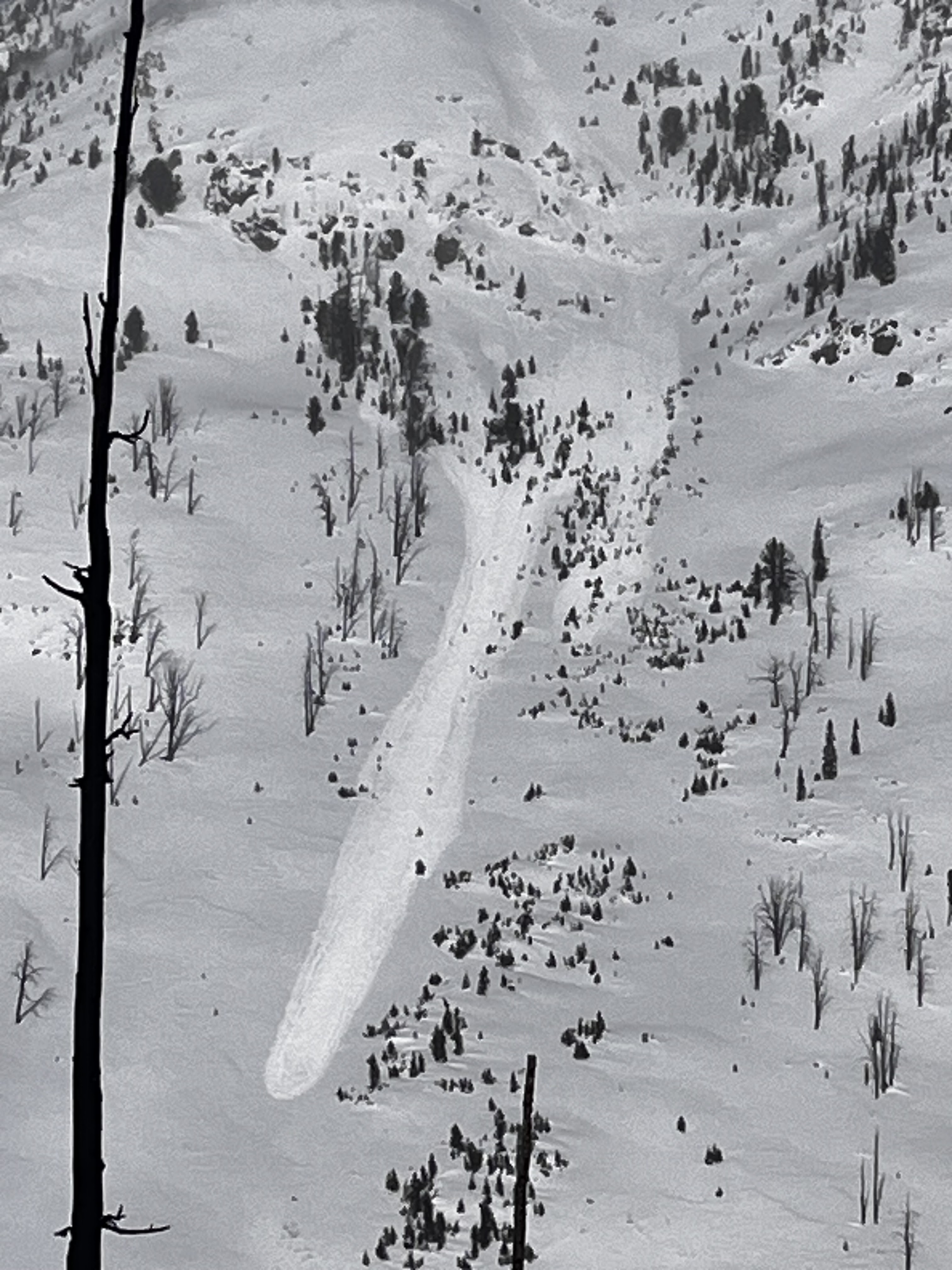
I saw evidence of a recent car-sized cornice fall on an E aspect. The resulting dry loose ran far, but saw no crown or evidence of a deeper avalanche.
Also noted a recent natural wind slab avalanche below ridgeline on a SE aspect at 9800’. It was around 60’ wide and ranged from 2-6” deep.
The clouds came out just in time, before the sun began to have any effect on solar aspects. Saw active wind transport over by Hyalite Peak, but it wasn’t as bad over in Divide.
Full Snow Observation ReportWe rode to the motorized boundary and toured up the shoulder of the Throne, poked out to the north-facing runs at the top, and then moved to the south-aspect gully from the upper saddle.
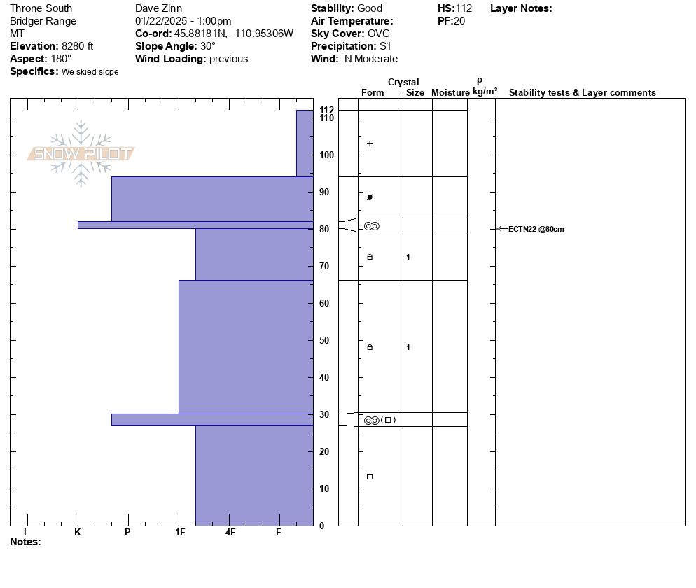
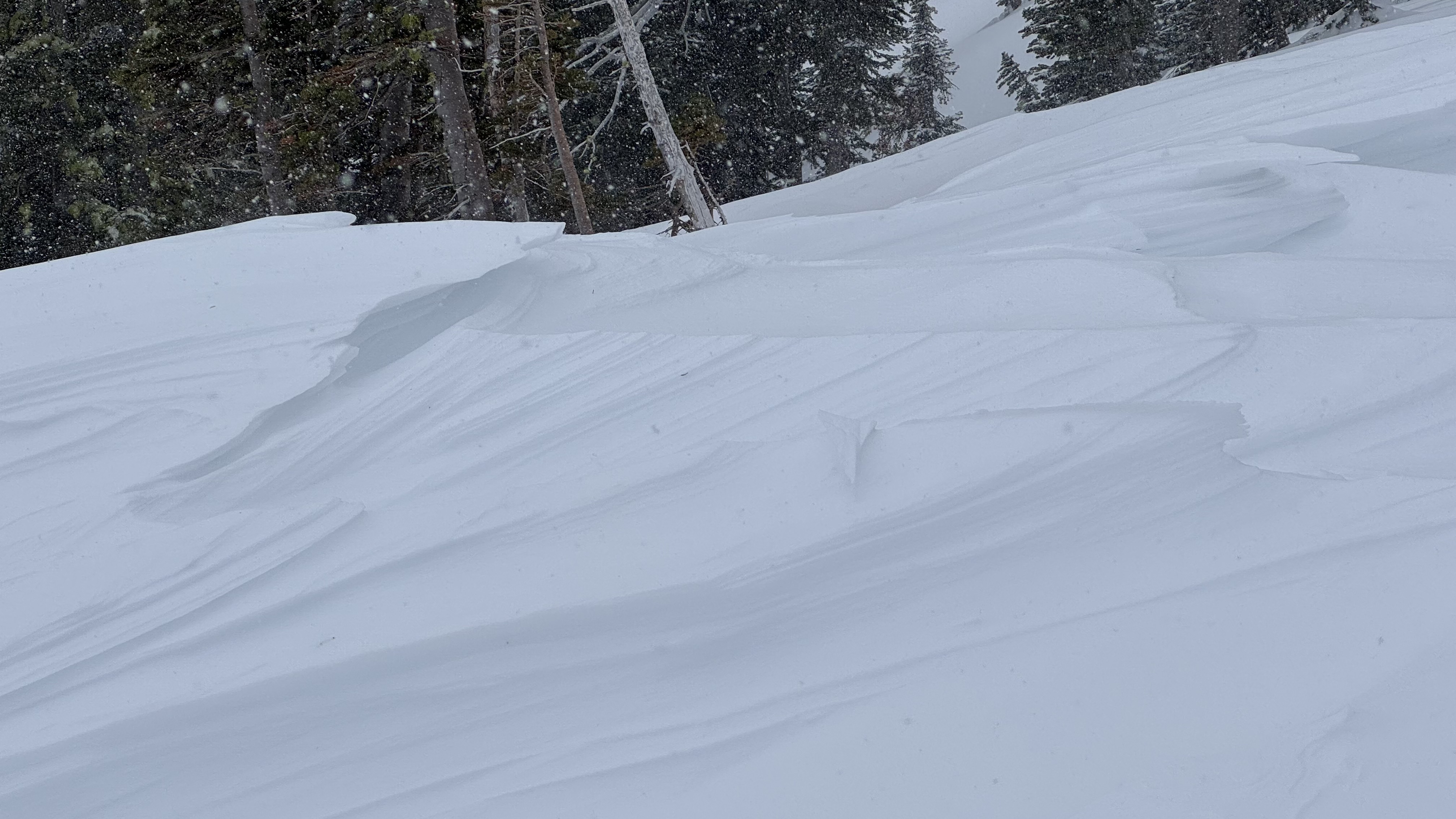
Winds have worked over many slopes near the Throne. We found some slopes stripped nearly to dirt with the snow blown off to who knows where, and others had wind-sculpted sastrugi. Trees were broken off, and debris littered the snow surface. We probed for snow depths. On the east face, depths ranged from 20 cm to 100 cm on the shoulder (we may have missed deeper spots). At the upper portion of the north-facing run, we found 50-75 cm depths. The south face had a 115 cm depth.
There was some isolated wind-loading mid-slope. We saw one old crown that was nearly drifted in on a steep break over at mid-elevation on the east face.
Somehow, we found a slope sheltered from the wind's effects. Because the danger is low on non-wind-loaded slopes, we considered traveling down through avalanche terrain. Before we did, we assessed stability to give us one last chance to turn around, and we followed safe travel practices, exposing one skier at a time to potentially hazardous terrain.
Full Snow Observation ReportThe danger was very LOW on most slopes as most of the snow was gone.
Today, we traveled into the Maid of the Mist basin and up and along the Palace Butte ridgeline. Although temperatures have warmed up significantly since the weekend, strong winds kept conditions frigid. Winds blew plumes of snow off the high peaks and at ridgelines, gusting 50-60 mph. Even at low to mid elevations, spindrift was blowing off of cliffs, snow was blowing out of trees, and the surface of the snowpack had been affected by wind. We found stiff, hardened surfaces and sastrugi starting around 8800', nearly 1000' lower than the tops of the surrounding ridgelines.
Most of the high elevation snow has been transported already. Up high, snow surfaces are hardened and we were mindful of wind slabs that have formed in the last few days.
On a north facing aspect at 8800' we got an ECTP 22 in our pit test on a wind slab over softer snow. We also dug on a south facing aspect and found new snow on top of a melt-freeze crust and small faceted grains. This crust likely formed during the warm temperatures before the cold spell last Thursday (1/16).
We heard one collapse on a heavily wind-loaded pillow of drifted snow, but beyond that, the only other sign of current instability was the active wind loading itself.
We chose to avoid traveling on slopes steeper than 30 degrees that had signs of wind affected snow (textured snow surfaces, stiffening of surfaces, and obvious wind pillows). Slopes that had not been affected by wind held the safest and highest quality riding.
Full Snow Observation ReportWind slab avalanche on E Henderson North of the large slide path close to Fisher Pk. R1 D2,1-2' deep, 200' wide. It broke aprx 200' below the summit mid slope. Phone was too cold to take photos. It looks like it broke on the 19th. Wind slabs 5-10" deep were easy to trigger on test slopes North o Lulu pass. Active loading today on upper elevation SW-SE aspects. Multiple ECTX test results on S aspects at 8600' over the weekend.
Full Snow Observation ReportVery reactive wind slabs developed overnight. 6-30inches thick.
Full Snow Observation ReportWind loading on all aspects due to swirling winds. Cracking about 3-12” thick around top of wolverine forest. No signs of persistent slab instability, deep snowpack throughout.
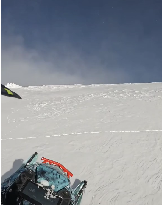
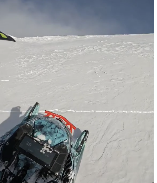
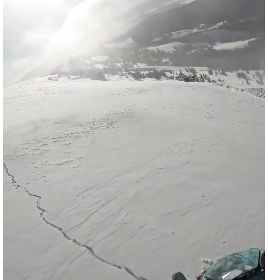
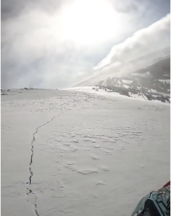
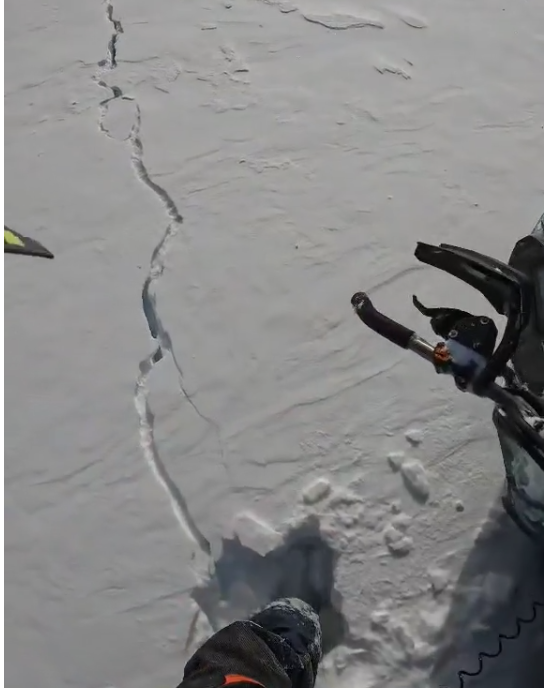
Full Snow Observation ReportFrom FB message 1/19: "In between redstreak peak and white peak... The whole slope cracked... the one I stopped on I put my leg in the crack and went to my knee inside the crack"
Screenshots from videos sent in messenger
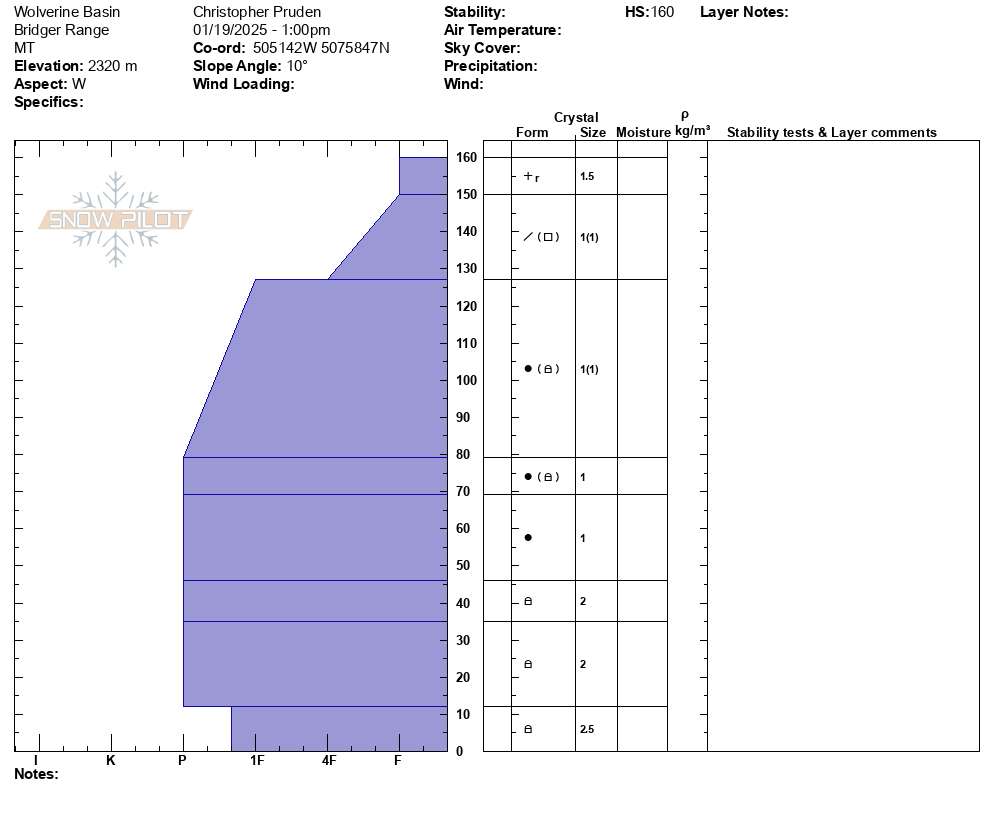
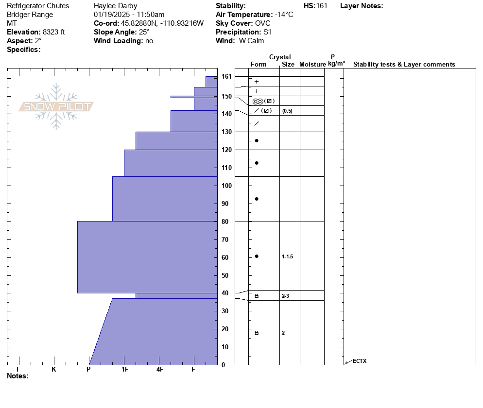
Full Snow Observation ReportSnow depth 160 and generally stabile conditions with the lower layers gaining some strength at this location. ECTX x3 in this area. Old wind slab observed in the area but no signs of instability on that layer.
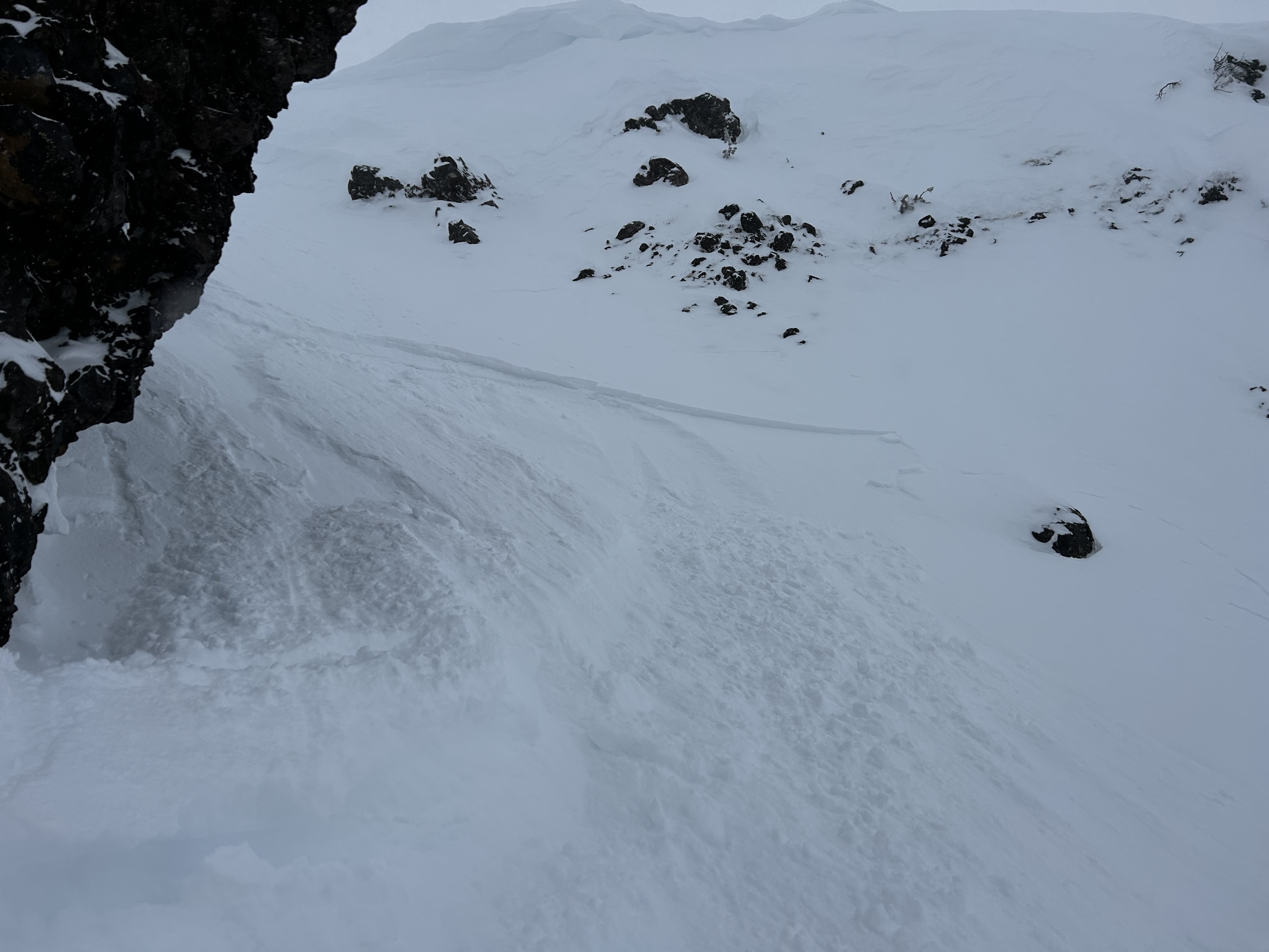
Full Snow Observation ReportWind was swirling in Maid of the Mist yesterday, mostly upslope winds that were transporting snow, but inconsistently and were difficult to predict where they were loading. We did not find widespread wind loading, but did get a very small windslab to release just below the top of the ridge (max 3-4" thickness, see image).
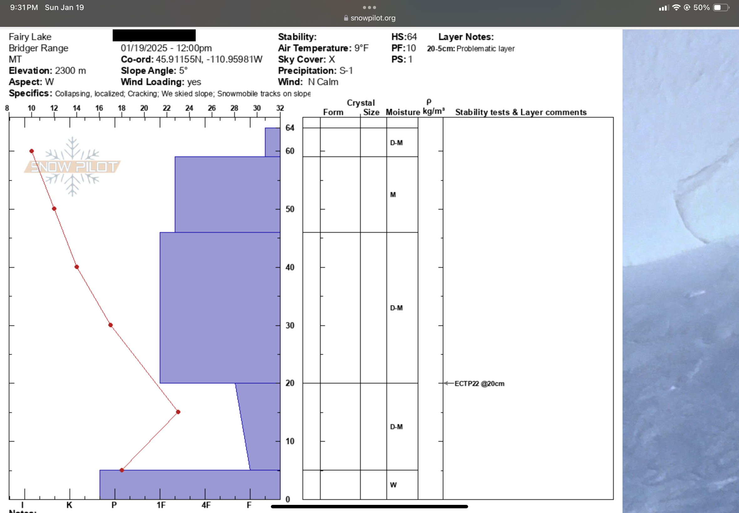
Full Snow Observation ReportECTP22 at 20CM. Bottom layer is a high concern to me. We experienced whumphs the entire walk in from the parking lot and had a pretty sketchy time attempting to ski a glade directly above fairy lake. The refrozen snow above the weak layer also adds some false security at a glance.
Full Snow Observation ReportAspect: East
Elevation: ~9000ft
Snow Depth: 155cm
Pit:
- 155-20cm 1F
- 20-0cm 4F/Fist
- ICT7 (Thin Crust layer at 135cm)
- ECTX
Snow:
- Wind affect up higher. Stayed out of bowl as our chief concern was triggering a wind slab loaded on the crust layer at 135cm. Did have shooting cracks at the top wind affected area. Great snow otherwise!
Full Snow Observation Report
Today, we braved the frigid temperatures and toured out of the Bradley's Meadow gate north of Bridger Bowl. Above Bradley's Meadow, we triggered a small soft slab avalanche on a south facing aspect around 7800'. This avalanche broke in a wind drift, 4" deep in low density new snow, likely on a sun crust or near-surface facets.
We toured up the Ramp and dug a snowpit on north facing aspect at 8200' Here we found a strong, deep snowpack just over 5' deep. Under 4" of new snow, we found a decomposing melt-freeze crust with near-surface facets, and underneath, a mostly right-side-up snowpack structure. The facets near the bottom of the snowpack have gained strength and were hard and rounding. We did not get unstable results in our pit tests here.
Additionally, during steady snowfall from late December through early January, in the Bridger Range and mountains near Bozeman we saw minimal (if any) avalanches break on weak snow near the bottom of the snowpack. This minimal activity combined with what we have been seeing in snowpits indicates deeper avalanches are unlikely.
Cracking within shallow wind slabs was the only sign on instability we saw today. We chose to ski 30-35º terrain, assessing for and steering clear of wind drifted snow as we made our way down.
Light snow fell all day (S1) and winds were calm on the ridge. There was also evidence of the strong winds earlier in the week in the form of large drifts in unusual locations across lower elevations. These drifts are worth being cautious of, though they are now stubborn to unreactive and being disguised by the new snow.
Full Snow Observation ReportDug a pit on divide peak on a southwest facing aspect that was about 210cm deep. ECTX, PSTX on sun crust 15cm down from surface that the new snow had fallen on. Entire snowpack 4F-1F from the thin sun crust to the buried facet layer than began around 165cm deep. Saw evidence of some wind slabs beginning to form near the ridge line. It was cold.
Full Snow Observation ReportSkied a few laps above Deer Creek today, E through SE aspects between 7000' and 8250'
Only about an inch of new snow in past 24 hours
Calm to light winds from E; blowing and drifting snow filling the skin track on isolated, wind-exposed terrain features above 7400'
No recent avalanches, whumphing, or shooting cracks observed
Average ski penetration 15-20 cm above 7000'
Dug a test pit on an E aspect at 8200'; HS 110 cm
ECTN 28 down 25 cm from top
Pit showed poor snowpack structure (30 cm of F-hard, 2mm facets at base) with 1F-hard slab sitting above. We were unable to affect the facet layer with our ECT and we were too cold to do a PST! A little extra force after the ECT did get a sudden collapse at the ground.
Full Snow Observation Report
Toured up W. Facing terrain on Mt. Nemesis coming out of the hut. Full range of sun crust, rime crust, wind crust, and consolidated powder between SW to NW aspects. Snow structure felt consolidated and stable in most areas but became hollow and slabby in rocky terrain ~8,800’ . We turned back and found a lower angle path down to the skin track.
Full Snow Observation Report
We rode around the north and south sides of Mt Jefferson, and Yale Creek. The danger has definitely dropped and the snowpack has stabilized a lot since I was last here on New Year's Eve when we experienced big thunderous collapses. The peak instability was around the first week of January. We could see evidence of just a few slides from that time. All the snowfall during that time made conditions dangerous then....but stable now. Since Xmas eve, this area has received snow containing 4.5-6.5 inche of water.
Today we didn't see any recent avalanches. We didn't experience any collapsing or cracking. We had stubborn stability tests with columns that took a lot of hard hits to break even where the snowpack was thinner.
I'm not ready to climb up steep chutes on Jefferson, but I'm feeling really comfortable in many other areas - especially places with a 5-6 ft deep snowpack.
Winds were moving a little snow. One wind slab/drift produced a shooting crack but we couldn't get any others to crack.
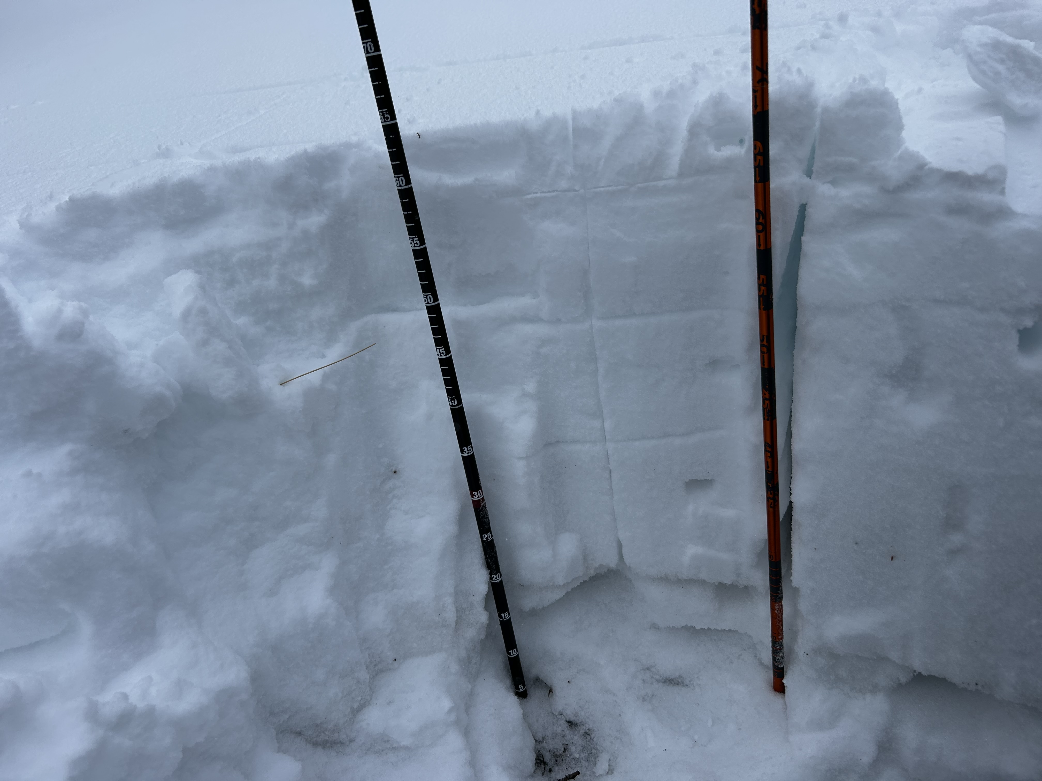
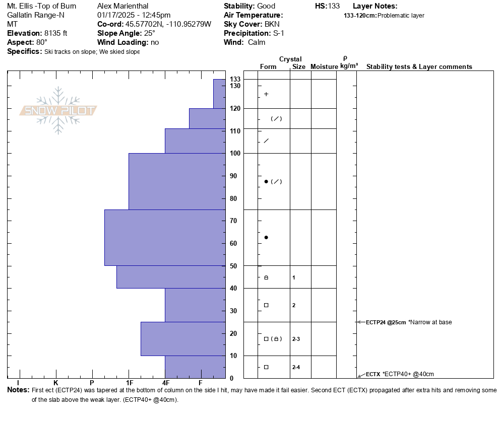
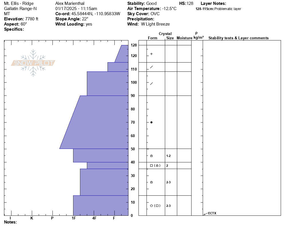
Full Snow Observation ReportWe skied to the top of Mt. Ellis via the ridge from the north. There was light wind on the ridge, otherwise calm. Snowing steadily this morning and tapered off by noon-1pm with skies clearing after noon. There were 2-4" of low density new snow. We dug a pit off the ridgeline on a northeast facing slope at 7,800' and one pit at the top of the burned slope, east facing at 8,100'. Profiles attached.
The first pit had an ECTX and the second had propagation with extra force. There were 2mm facets 30cm off the ground in both pits which were slightly softer in the higher pit. Snow depth was 3-4 feet up high and around 2 feet lower in the thicker trees and along the trails.
Beyond what we saw today, evidence of good stability in the northern Gallatin Range also includes not having heard of any avalanches (or only 1-2 small pockets) breaking on the weak layers near the bottom of the snowpack during the 2-3 weeks of steady snowfall from late Dec to early Jan. The snowpack has had a break from loading for the last few days which has allowed avalanche potential to continue to become less likely.
In general, stability was good and we felt good skiing slopes steeper than 30-35 degrees, while exposing only one person at a time.
Full Snow Observation Report
