Photos
|
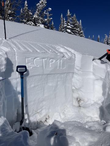
Southern Madison, 2025-02-21 This snowpit on a SE aspect was made up of a dense slab of recent snow, sitting on top of many different layers of junky, faceted grains. Propagation was easy to find (ECTP 11, HS: 112). Photo: GNFAC Link to Avalanche Details |
|
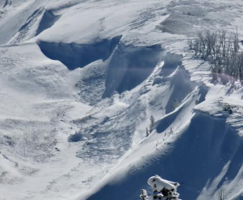
Southern Madison, 2025-02-21 We saw up to five recent avalanches from the last few days. 1-2 looked to have failed on PWLs, and the rest were wind slabs. Cornice collapses triggered at least two of these avalanches. Photo: GNFAC Link to Avalanche Details |

|
Cooke City, 2025-02-20 Today we observed a couple day old wind slabs in steep SW facing terrain on Mt Zimmer. Photo: BPG Link to Avalanche Details |
|
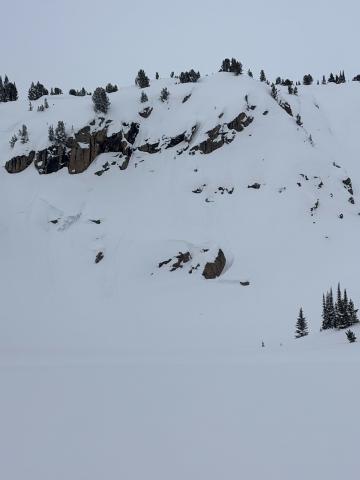
Cooke City, 2025-02-20 Wet loose occurred sometime today between 11-2 pm on S facing terrain nearby. Photo: BPG Link to Avalanche Details |
|
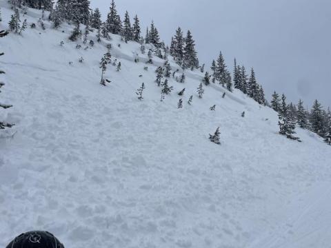
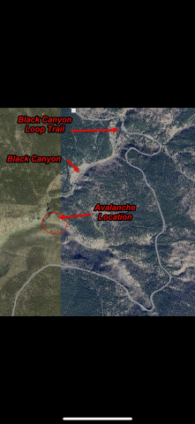
Out of Advisory Area, 2025-02-20 Remotely triggered slide in Black Canyon |
|
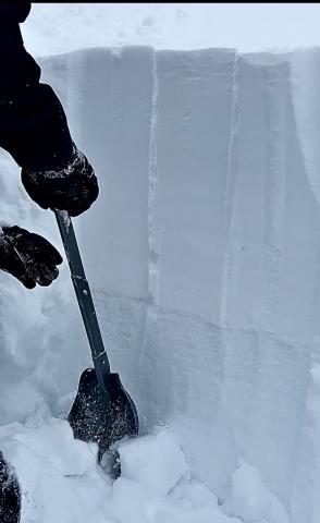
Lionhead Range, 2025-02-20 At Lionhead a weak layer generally 2-3 feet deep is obvious in this snowpit wall. |
|
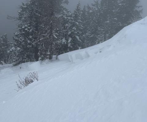
Lionhead Range, 2025-02-20 Remotely triggered the avalanche from 150 feet away. It broke 200' wide and 1-3 feet deep. It ran an estimated 200' vertical feet |
|
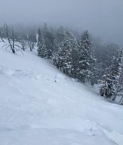
Lionhead Range, 2025-02-20 Remotely triggered the avalanche from 150 feet away. It broke 200' wide and 1-3 feet deep. It ran an estimated 200' vertical feet |
|
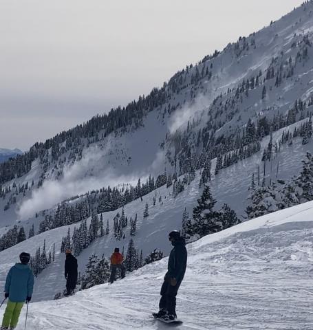
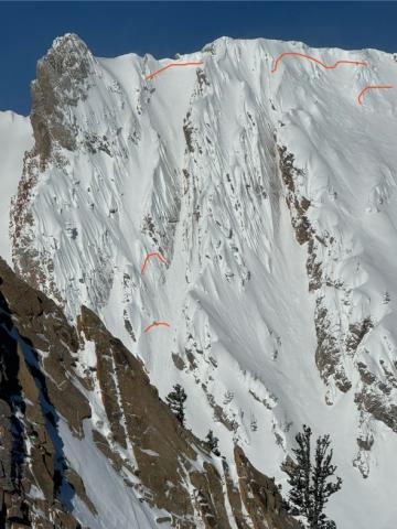
Bridger Range, 2025-02-20 Skiers triggered a medium sized cornice fall that triggered a dry loose (sluff) avalanche that created large powder cloud. Link to Avalanche Details |
|
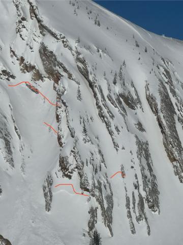
Bridger Range, 2025-02-20 Toured out to Frazier Basin and turned around seeing widespread avalanches and active wind loading. Despite our pits on the Throne the day before showing no weak layers, the amount of wind loading and potential for slabs over density changes gave us pause. Good skiing and sledding down low. Link to Avalanche Details |
|
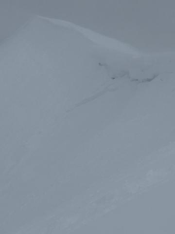
Out of Advisory Area, 2025-02-19 From SnoWest Forums FB Page: “Just getting word of a LARGE Remote Rider Triggered Slab Avalanche down inside of Black Canyon itself just off the Black Canyon Loop Trail in Island Park. |
|
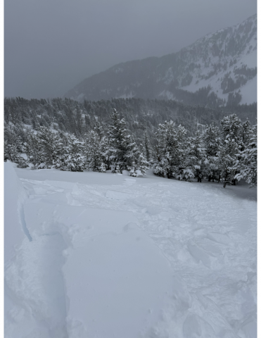
Bridger Range, 2025-02-18 Cornice broke in between north and south saddle peaks. The initial propagation width was hard to distinguish. Maybe 50 feet. About 18 inches deep at height of crown. Photo: Anonymous Link to Avalanche Details |
|
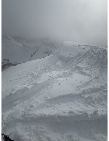
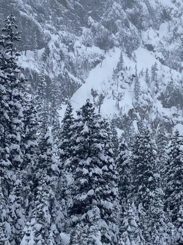
Northern Gallatin, 2025-02-18 From obs: "2/17 Immediately noticed signs of wind loading and wind slabs on NE-E aspects once in the basin. New cornices have formed in the last couple days along the North ridge to the summit. Cornice collapse on the summit triggered a small wind slab on an isolated slope." Photo: R. Rintala Link to Avalanche Details |
|
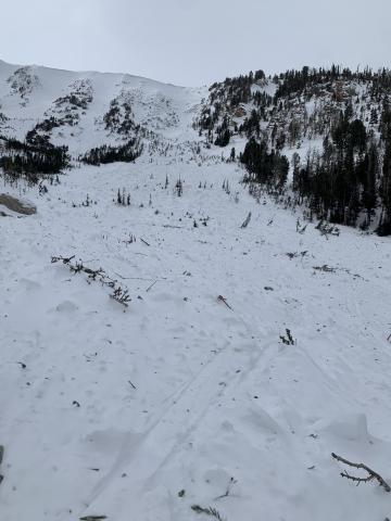
, 2025-02-18 From obs: "3 small storm slabs observed on steep terrain of Bridger Ridge (E aspect observed from wolverine woods) Attached is a photo of the deepest likely ~12in crown. No observed wind slab development below 8100ft. No propagating test results in pits dug Lower ramp, and wolverine woods." Photo: L. Butler Link to Avalanche Details |
|
Out of Advisory Area, 2025-02-18 From obs" "Observed a few old avalanches today, maybe from the 2/8 storm. Although well out of the advisory area, helpful for skiers in the Red Lodge Area. 1) Silver Falls Cr (Lake Fork), 9200', E, HS-N-R4-D1.5-O 45cm thick pencil hardness slab, HS 135. Pulled out into upper 20 degree terrain. 2-3 avalanches here, with one crown ~600' long. 2) Misery Bowl (Main Fork), 9400', ESE, HS-N-R2-D2.5-O A few avalanches here similar to above, with one significantly larger avalanche appearing to have failed on depth hoar where the bowl tips South. 2-4' crown, ran about 600' vertical."
|
|
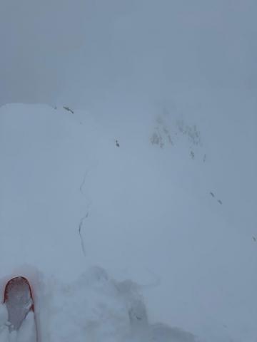
Northern Madison, 2025-02-18 Cracking in the new and wind-drifted snow on the Ridge of Middle Basin. These resulted in a narrow avalanche that ran quite far. Link to Avalanche Details |
|
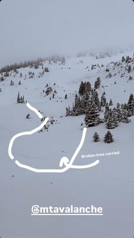
Bridger Range, 2025-02-18 Skiers saw three natural slides south of the throne today. All east facing. Photo: I Freeland Link to Avalanche Details |
|
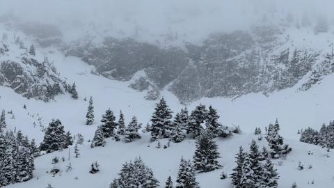
Bridger Range, 2025-02-18 Skiers saw three natural slides south of the throne today. All east facing. Photo: I Freeland Link to Avalanche Details |
