Advisory Archive
The southern mountains got an inch of snow last night while other areas were missed. Temperatures are in the teens to low 20s with winds out of the southwest at 25-40 mph. Today will become cloudy, winds will decrease and a cold front will usher in snow later this afternoon. By morning 2-4” will blanket the mountains with another couple inches on Thursday.


This is the 3rd morning in a row without new snow to report, the first time in 23 days to have such a drought! Under clear skies temperatures are in the single digits and winds are blowing W-SW at 20-35 mph in the north and 10-15 mph in the south. Today will be sunny and temperatures will rise into the 20s and drop into the teens tonight. No snow is expected until later Wednesday.
The mountains did not get any new snow since yesterday morning. Temperatures this morning are negative teens F in the Bridger Range and single digits above and below zero elsewhere. Wind has been east-southeast at 5-15 mph and 25-35 mph in the Bridger Range. Today, temperatures will reach single digits to high teens F. Wind will be easterly at 5-20 mph and shift to the north-northwest this evening. The southern mountains will get light snow showers today with 1-2” possible by tomorrow.

Yesterday morning the mountains near Bozeman and Big Sky received a trace of snow as showers tapered into a cold, clear day throughout the advisory area. This morning, temperatures are in the single digits F and will reach high teens to low 20s F today. Strong north-northwest wind yesterday afternoon shifted overnight to westerly at 15-25 mph with gusts of 30-45 mph. West wind at 20-30 mph will continue this morning. Cloud cover will increase later today and snow showers tonight will bring 1-3” to the mountains by morning.

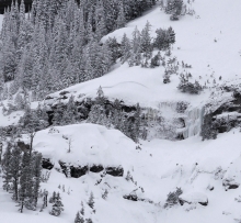
Since yesterday morning the mountains got 6” of low density snow in Hyalite, 2-4” in the Bridger Range, Big Sky and near Cooke City, and zero near West Yellowstone. Temperatures this morning are single digits to low teens F and wind is north-northwest at 5-15 mph. Under mostly sunny skies today, temperatures will reach teens F with north-northwest wind at 5-15 mph. Winds will increase to 20-30 mph tonight and the next chance for snow is Sunday night.

Over the past 24 hours the mountains around Cooke City picked up 8-10” of new snow while the rest of the advisory area picked up 1-2”. At 5 a.m. temps range from the single digits F in the Bridgers to teens and 20’s elsewhere. Winds are blowing 15-30 mph out of the W-NW with ridgetop gusts around Hyalite and Big Sky breaking 40 mph. Today, temps will warm into the teens to low 20’s and winds will continue to blow 15-30 out of the west. Llight snow will linger in the mountains with an additional 1-2” possible. Snow moves out of the region by this evening and this weekend looks to be cold and dry.


Since yesterday morning the mountains around Cooke City picked up close to a foot of new snow. The Bridger Range picked up 6-8” while Hyalite and Big Sky received 2-4”. The mountains around West Yellowstone squeezed out 1-2”. This morning it’s still snowing around Cooke City while the rest of advisory area remains dry. Temps range from the 20’s to low 30’s F and winds are blowing 15-30 mph out the W-SW with ridgetop gusts around Big Sky breaking 40 mph. Today, snow will continue around Cooke City where an additional 4-6” will fall by this evening. The rest of the advisory are could see 1-2” by later today. Snow increases tonight and much of the advisory area will see 4-6” by morning. The exception is the mountains around West Yellowstone which will see 1-3”.
Since yesterday morning 3-4” fell in the mountains around Bozeman, Big Sky, Cooke City and 1-2” outside West Yellowstone. Under cloudy skies, west winds are averaging 25-30 mph with gusts of 55 mph in the north and 15-30 mph in the south. By tomorrow morning expect 2-4” in the mountains around Bozeman and Big Sky, and 4-8” around West Yellowstone and Cooke City. Temperatures will reach the low 20’s this afternoon with strong westerly winds.
Since yesterday morning 5-6” fell in the Bridger Range and Cooke City, 3” around Big Sky and 1” everywhere else. Winds have decreased and are blowing out of the west at 10-20 mph with gusts of 35. Under cloudy skies mountain temperatures are in the mid-teens. Occasional showers today and tonight will drop 2-4” by tomorrow morning with winds remaining the same and temperatures climbing into the low 20s.

Since yesterday morning, 10-12” of dense new snow fell in the mountains near Cooke City and the northern Bridger Range. Near Bridger Bowl and Hyalite got 1-2” of new snow, and near Big Sky and West Yellowstone got 2-4”. Temperatures are currently high teens to 20s F. Wind overnight was westerly at 20-30 mph with gusts of 50-60 mph. Today, temperatures will be in the 20s F with westerly wind at 20-30 mph. Snow showers will continue through tonight with 4-6” in the mountains by tomorrow morning.