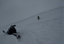
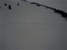
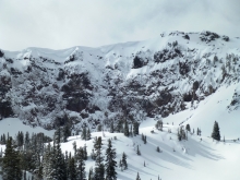
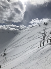
Advisory Archive
Over the past 24 hours the Bridger Range picked up 6-8” of high density snow. The mountains around Big Sky and Cooke City picked up 3-6” while the mountains around West Yellowstone picked up 1-2”. This morning it’s still snowing lightly in the northern mountains and temps range from the mid to high 20’s F. Winds are blowing 20-40 mph out of W-SW in the mountains around Bozeman, Big Sky and Cooke City and 15-25 mph in the mountains near West Yellowstone. Today, highs will warm into the upper 20’s to low 30’s F and winds will remain moderate to strong out of the W-SW. Light snow will continue in the northern mountains which will see another 1-3” by this afternoon. Heavier snow returns tonight dropping an additional 4-6” in the northern mountains and Cooke City. The mountains around West Yellowstone will receive 2-4”.


Since yesterday morning the mountains near West Yellowstone and Cooke City picked up 1-2”
of new snow while the rest of the advisory area remained dry. At 5 a.m. temps are in the teens to low 20’s F and winds are blowing 15-35 mph out of the W-SW. Today, temps will warm into the upper 20’s to low 30’s F and winds will remain moderate to strong out of the W-SW. Skies will be cloudy throughout the day and there’s an increasing chance of snow this afternoon and evening. By tomorrow morning the mountains will see 2-4” of new snow.
Winter has Spring in a head-lock and won’t let go. Since 5 a.m. yesterday morning 4” fell in the Bridger Range, 8-10” around Big Sky and the southern Madison Range, 4” outside West Yellowstone and 6” outside Cooke City. Temperatures are in the single digits under partly cloudy skies and wind is west to northwest at 20-35 mph in the northern areas and 10-25 mph in the south. Today will remain partly cloudy with mountain temperatures reaching the high 20s. Wind will remain the same speed, but shift southwest. Tonight 1-2” of snow is expected.

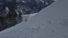
At 5 a.m. heavy snowfall has dropped 10” near Cooke City, 8” in the Bridger Range, 6” near Big Sky and 1” near West Yellowstone. Temperatures are mid-20s F with west to southwest wind at 15-20 mph and gusts over 30 mph. Temperatures will warm to high 20s and low 30s F this morning, then drop to teens F this afternoon and single digits F tonight. Wind will shift to the northwest at 20-35 mph. Heavy snow continues through this afternoon and will taper off overnight. By this evening the mountains will get another 6-8” near Bozeman and Big Sky, 3-5” near West Yellowstone and Cooke City, and 1-3” more overnight.


Yesterday morning, the Bridger Range got 7” of cold, low density new snow while the rest of the advisory area did not get any. Temperatures this morning are teens to low 20s F and wind is west-northwest at 5-15 mph with gusts to 25 mph. This morning will be partly sunny and cloud cover will increase through today. Temperatures will be 20s to low 30s F with west-southwest wind at 20-30 mph this afternoon. A warm spring storm is expected overnight and tomorrow, and the mountains will get 3-5” of snow by morning and 4-7” tomorrow.
Over the past 24 hours the mountains around Cooke City picked up 2-3” of new snow while the rest of the advisory area squeezed out 1-2”. Currently, temps are in the teens to low 20’s F under mostly cloudy skies and winds are blowing 15-30 mph out of the W-SW. Today, snow showers will linger in the northern mountains which could see and additional 1-2" by late morning. Snow exits the area by early afternoon and there's a chance for sunshine later in the day. Highs will warm into the 20’s to low 30’s and winds will be light to moderate out of the W-NW. Little to no snow is expected overnight.
Over the past 24 hours the mountains picked up 1-2” of new snow. At 5 a.m. temps range from the teens to mid-20’s F and winds are blowing 15-30 mph out of W-SW. Today, highs will warm into the upper 20’s to mid-30’s F under mostly cloudy skies and increasing winds will shift to the W-NW. A weak storm moves over the area this afternoon and evening. The northern ranges including Cooke City could see 1-3” by tomorrow morning while the mountains around West Yellowstone will see a trace to 1”.

Since yesterday morning the northern Gallatin Range and mountains around Big Sky picked up 3-5” of new snow. The Bridger Range and Cooke City received 1-2” while the West Yellowstone area remained dry. This morning temps are in the teens F under partly cloudy skies and winds are blowing 10-25 out of the W-NW. Today, highs will warm into the mid to upper 20’s F and winds will blow 15-30 mph out of the W-NW. Skies will be mostly cloudy in the north and partly cloudy in the south. The mountains around Bozeman, Big Sky and Cooke City could see 1-2” of new snow by tomorrow morning.
At 5 a.m. most mountain locations have 4-5” of new snow and closer to 8” up Hyalite while valleys have rain. Mountain temperatures are in the upper teens to low 20s and winds are W-NW at 15-25 mph with gusts of 40 mph. Snowfall will continue on a northwest flow and drop another 1-2” before ending later this morning. Wind will decrease through the day and skies will become partly cloudy.
Yesterday a trace to 1” of snow fell up Hyalite, but nowhere else. This morning skies are clear and temperatures are in teens with strong winds blowing 35-45 mph out of the west in the northern mountains and 10-25 mph elsewhere. Winds are blowing at all elevations, not just the ridgelines. Sunny skies this morning will become cloudy this afternoon as winds remain strong, but shift northwest. Snow will fall this evening and by morning the mountains will have 2-4” with the Bridger Range possibly getting double that.