Advisory Archive
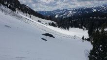
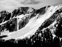
Over the past 24 hours heavy snow has impacted the mountains. By 2 p.m. on Friday the Bridger Range picked up 18” of new snow while the mountains near Big Sky received over a foot. The mountains near Cooke City and West Yellowstone received 6-8 inches. The northern ranges could see an additional 3-6 inches before the storm is over. The southern mountains could see another 1-3 inches. Winds are 15-25 mph out of the W-NW and temperatures are in the 20s F. Tonight, snow will taper off and temperatures will drop into the mid-teens to low 20s F. Winds will shift to the N-NE. Tomorrow will be dry and temps will warm into the 40s F under partly cloudy skies. Winds will remain light to moderate out of the N-NE.
This morning mountain temperatures are in the 30s F under mostly cloudy skies and winds are blowing 5-20 mph out of the west. Today, a weak cold front pushing down from the north will keep temperatures ten degrees cooler than yesterday. Highs will only reach the low to mid 40s F and winds will continue to blow 5-20 mph out of the west. Skies will remain mostly cloudy through the day, but no rain or snow is expected. A ridge of high pressure builds tomorrow producing a warm and sunny start to the week.
Temperatures reached the low 60s F yesterday and are in the mid-30s to high 40s F this morning. Winds are out of the southwest at 10-20 mph with gusts around 30 mph along ridgelines. Today will be mostly sunny with wind out of the west at 15-25 mph and temperatures in the 50s F. A cold front will bring increased cloud cover this afternoon with cooler temperatures and a chance for showers this evening.

Temperatures reached the mid-50s F yesterday and are in the low to mid-30s F this morning, except in the Bridger Range where temperatures are around 40 F. Winds yesterday afternoon were out of the northwest at 15-20 mph and calmed to 5-15 mph overnight. Today will be sunny with wind at 5-10 mph and temperatures near 60 F this afternoon.
Temperatures warmed to the mid-40s F yesterday and are in the high 20s to low 30s F this morning. Winds yesterday were out of the west-northwest at 30-40 mph with gusts in the 50s. Today will be sunny with wind at 5-15 mph and temperatures near 50 F this afternoon. Tonight and tomorrow will be the warmest part of the week.
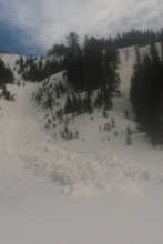
Yesterday morning a snow squall dropped 2-4” in the Bridger Range, up Hyalite and at Big Sky. In the mountains, temperatures barely cracked above freezing as west winds blew 20-30 mph with gusts of 45 mph. At 5 a.m. temperatures are in the low 20s under partly cloudy skies. Today will become mostly sunny with mountain temperatures reaching 50F before lightly freezing tonight as ridgetop winds decreasing to 15-25 mph. Today through Friday we are on track to get hit with a massive storm…a solar storm, with temperatures hitting a record breaking 70+F. My pasty white skin doesn’t stand a chance and wearing my favorite tank top is probably a bad idea, and not just because of sunburn.
Thunder, lightning, rain and snow all blessed southwest Montana yesterday. This morning the mountains have 2-4” of new snow with temperatures in the teens to low 20s. West winds are blowing 30-40 mph and gusts hit 60 mph last night. Today will start mostly cloudy and windy with temperatures rising into the mid-40s this afternoon as dry, warm and sunny weather brings temperatures to the mid-70s by Friday. You’ll wear mud boots today, sneakers tomorrow and flippity-flops on Friday.
Overnight temperatures dropped to the mid to low 30s F under mostly clear skies and winds are blowing 5-15 mph out of the W-SW. Today, skies will start out clear and temps will quickly warm into the upper 30s to low 40s F. Winds will increase through the day blowing 15-30 mph as a storm approaches from the west. By this afternoon skies will become mostly cloudy and there is a slight chance for a mountain rain or snow shower. Precipitation increases overnight and the mountains should see 1-2 inches of snow by tomorrow morning.