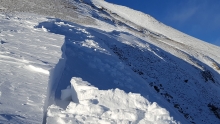
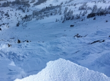
Advisory Archive
Temperatures at 4 a.m. are teens to single digits below zero F, and the mountains did not receive any new snow over the last 24 hours. Strong wind is the weather highlight this morning. In the Bridger Range wind is 30-40 mph out of the northwest with gusts near 50 mph. Wind elsewhere is out of the northwest at 15-25 mph with gusts of 30-40 mph. Temperatures today will rise to the low teens F this afternoon. Wind will be out of the west to northwest at 20-35 mph. Skies will be partly cloudy today and snow showers are expected tomorrow evening.


Bundle up out there because it’s COLD! Temperatures this morning range from -15 to -25 F with wind chills in the -30 to -40 range. With such cold temps no new snow fell overnight, but the southern mountains did pick up 3-4” during the day yesterday. Currently, skies are clear and winds are blowing 10-25 mph out of the N-NW. Today, highs will struggle to climb above zero degrees F and winds will continue to blow 10-25 mph out of the N-NW. Skies will become partly to mostly cloudy by tonight and winds will steadily increase shifting to the W-SW. However, no new snow is expected tonight or tomorrow.
At 4 a.m. temperatures range from below zero F in the Bridger Range to the mid-20s F near West Yellowstone. Over the past 24 hours the mountains near Cooke City and West Yellowstone received 1-2 feet of new snow, the Big Sky area and Bridger Range got 6”, and Hyalite got 1-2”. Wind yesterday was out of the west at 15-25 mph with gusts in the 50s. Wind this morning has shifted to the north at 5-10 mph. Temperatures today will be in the single digits F and drop to negative teens F this evening. Wind will remain calm out of the north-northeast with speeds increasing to 15-20 mph this afternoon. The southern mountains will get 5-7” of snow today and the northern mountains will get 2-3”.

Overnight the mountains around Big Sky, West Yellowstone and Cooke City received 4-6” of new snow and it’s still snowing. The mountains around Bozeman received 1-2”. At 5 a.m. temperatures range from the teens to mid-20s F and winds are blowing 15-30 mph out of the W-SW with gusts upwards of 50 mph being recorded around Big Sky and Hyalite. Today, a strong westerly flow will continue to push moisture into the area producing additional mountain snowfall. The southern ranges will see consistent snowfall today and tonight with 8-10” likely by tomorrow morning. The mountains around Bozeman will see more intermittent snowfall, but should see 3-6” by tomorrow morning. Highs today will warm into the mid to upper 20s F and winds will remain moderate to strong out of the W-SW.
There’s no new snow to report this morning. Winds are out of the west at 15-20 mph with gusts in the 30s and temperatures near 0F. Clouds will thicken today as a westerly flow of moist Pacific air brings snow tonight through tomorrow. By morning the mountains will have 5-7” with the storm continuing through Thursday. Today, mountain temperatures will rise to near 10F as winds continue out of the west at 20 mph.
In the last 24 hours the mountains around Big Sky and Cooke City picked up an inch of snow. Skies are clearing, temperatures are zero to 10F and winds are blowing 20-30 mph with gusts in the 40s out of the west to northwest. Today will become mostly cloudy and remain windy with mountain temperatures climbing into the teens. A trace to one inch of new snow may fall in the southern mountains tonight. Another storm will hit Wednesday evening with subzero temperatures by weeks end.
Since yesterday morning the mountains near Big Sky and Cooke City received 3-4” of new snow, other mountains in our area got 1-2” of snow, and the Bridger Range did not get any new snow. Temperatures this morning are in the single digits to low teens F. Wind has been out of west-northwest at 15-25 mph with gusts between 30-50 mph. Westerly wind will continue today at 25-30 mph. Temperatures will be reminiscent of last week with highs in the low teens F. The mountains will get 1-2” of new snow by tomorrow, with more near Cooke City.


Snowfall totals since yesterday morning are 6-8” in the Bridger Range and Cooke City, and 3” throughout the rest of our advisory area. Wind has been out of the west to northwest at 15-25 mph with gusts over 50 mph yesterday afternoon. Today, wind will be out of the west to southwest around 10-15 mph with speeds increasing to around 30 mph this evening. Temperatures this morning are in the single digits F and will reach the mid-20s F today. The mountains will get 3-6” inches of snow tonight with more expected through tomorrow.

This is my type of weather pattern – warm and snowy. Over the past 24 hours the mountains across the advisory area picked up 3-5” of new snow. Currently, light snow is falling in the mountains south of Bozeman. Temperatures are in the 20s F and winds are blowing 15-30 mph out of the W-SW. Today, a strong westerly flow will continue to usher moisture into the area. The southern ranges will likely pick up 2-4” by tomorrow morning while the mountains around Bozeman will pick up 1-2”. This pattern will also keep temperatures on the mild side. Today, highs will climb into the upper 20s F, a welcomed change from the sub-zero temps that gripped the area over the past week. Winds will continue to blow 15-30 mph out of the W-SW.
