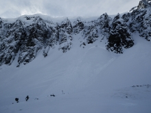
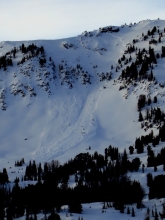
Advisory Archive
This morning temperatures were in the mid 20’s F near Bozeman and Big Sky with winds blowing 15-20 mph and gusting to 30 mph from the S and W. Further south near West Yellowstone and Cooke City, it was colder and calmer with temperatures in the teens F and winds blowing 5-10 mph. Today will have mostly sunny skies, temperatures near 30 degrees F and winds that will increase a bit.


Last night’s cold and clear skies made good flying conditions for Santa. I could barely sleep, all excited about what he was bringing me. But when I looked outside for my new truck, I just saw my dented old one. I was dissed by Santa again. But at least I’ve got a nice day ahead of me: fresh snow from the weekend, southwest winds blowing 15 to 30 mph (NW direction in Cooke City), and temperatures in the teens that will reach into the high twenties this afternoon under mostly sunny skies. Overall, high pressure dominates with no snowfall predicted in the next few days.


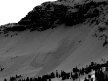
Snowfall continued through last night with 24 hour totals of 4-6 inches in the mountains around Bozeman, Big Sky and West Yellowstone. Cooke City received over a foot. Winds increased yesterday out of the west to southwest at 20-40 mph, but spiked last night with gusts near 60 mph. Cooke City still has strong northwest winds blowing 30-50 mph. Today will become partly cloudy and temperatures will rise into the upper twenties by this afternoon. No new snow is expected and Santa should have good visibility as he makes his rounds to all those naughty and nice.

Over the past 24 hours the mountains around Bozeman and Big Sky as well as Cooke City picked up 4-6 inches of new snow. The southern Madison Range and Lionhead area near West Yellowstone picked up 2-4 inches.
This morning, temperatures are 10 degrees F around Cooke City and West Yellowstone and the mid to high teens elsewhere. Skies are partly to mostly cloudy and winds are blowing 10-20 mph out of the west-northwest. Today will be the warmest day of the week with highs climbing into the upper 20’s to mid-30’s F. Winds will gradually increase through the day as the next storm system approaches from the northwest. There is a slight chance of mountain snow showers this afternoon with an increasing chance for snow tonight and tomorrow. The mountains around Bozeman and Big Sky will receive 2-4 inches by tomorrow. The southern mountains will likely pick up 4-6 inches.

If fresh powder is at the top of your wish list you’re in luck. Since midnight, the northern mountains have received 5-7 inches of new snow while the mountain around West Yellowstone and Cooke City picked up 2-4 inches. This latest round of moisture has been delivered on a northwest flow, which will likely persist through much of the day. By this afternoon, an additional 2-3 inches is possible in the mountains around Bozeman and Big Sky. The southern mountains should see an additional 1-2 inches.
This morning, temperatures are ranging between 10-15 degrees F and winds are blowing 10-20 mph out of the west with higher gusts being recorded around Big Sky. Today, temperatures will warm into the high teens to low twenties F and winds will continue to blow 10-20 mph out of the west. A northwest flow aloft will keep conditions unsettled for the next few days. Monday night into Tuesday looks to be the best chance for more accumulating snowfall.
Snow returned last night and was still falling this morning. As of 7 a.m.
- 10 inches of snow fell in the Bridger Range
- 8-12 inches fell near Big Sky and the northern Madison Range
- 5-9 inches near West Yellowstone and the southern Madison and Gallatin Ranges
- 4-6 inches near Cooke City and in the northern Gallatin Range.
In the northern half of the advisory area this morning, winds were blowing 15-20 mph from the W gusting to 30 mph with temperatures in the low teens F. In the southern half, winds were blowing 10 mph from the SW gusting to 15-20 mph with temperatures in the single digits F. Temperatures may drop a few more degrees in the mountain near Bozeman and Big Sky and most places should have temperatures in the single digits F today. Wind speeds shouldn’t change much but will shift to the NW. Snowfall will continue with another 2-3 inches falling mostly near Bozeman and Big Sky.
Yesterday morning snow fall quickly ended with no more accumulation and the sun came out. North winds blew 15-20 mph gusting 30-40 mph. This morning temperatures dropped into the single digits F and winds shifted to the W averaging 10-15 mph gusting to 20 mph. Clouds should move over the area today with snow fall starting early this evening. Temperatures should climb into the low to mid teens F and winds will increase some and shift to the SW. Snow will favor the mountains near Bozeman where 5-7 inches should fall by tomorrow morning. The mountains near Big Sky should get about 5 inches, near West Yellowstone 3-5 inches, and near Cooke City 2-3 inches.
This morning the Bridger Range received 7-9 inches of new snow. South of Bozeman near Hyalite Canyon and Big Sky 2-3 inches fell. Further south near West Yellowstone and Cooke City only about ½ inch fell. Temperatures were dropping this morning with the coldest temperatures of 10 degrees F in the Bridger Range. It was 15 degrees F near Big Sky and 20 degrees F near West Yellowstone and Cooke City.
This morning at 7 a.m. snowfall was slowing and should end this morning with only an inch or two of additional snow. Light winds were only blowing 5-10 mph from various directions but should increase as they shift to the north and blow 10-20 mph. Temperatures will drop into the single digits and low teens F. The next round of snow should come Friday evening.
Under partly cloudy skies temperatures are in the high twenties with ridgetop winds blowing southwest at 20-30 mph. Today clouds will increase as winds remain the same and temperatures climb into the mid-thirties. A cold front will arrive tonight and drop mountain temperatures into the single digits, but snowfall looks to be minimal with only 1-2 inches falling.
Warm and windy weather will continue today. Mountain temperatures are in the 20s except around Cooke City and West Yellowstone where they are in the teens. Today, temperatures will rise into the upper twenties to low thirties under mostly sunny skies. Winds have been out of the southwest at 20-30 mph with gusts of 50 mph and will remain unabated. Snow and colder weather is forecast for Wednesday night, so do not despair!