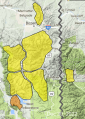
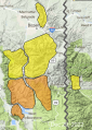
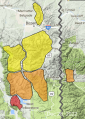
Advisory Archive

This morning temperatures are in the teens F with SW-W wind blowing 10-20 mph. Yesterday, an inch of snow fell in West Yellowstone. Today will be mostly cloudy with SW wind blowing 20 mph. This afternoon snowfall is expected to start in the southern ranges and by morning the mountains around West Yellowstone and Cooke City will have 2” and a trace to 1” falling everywhere else.


This morning, temperatures are in the single digits to low teens F with 10-20 mph winds from the west to southwest. Cooke City received 2” of new snow with 1” in West Yellowstone. Today, temperatures will be in the upper teens to low 20s F with 10-15 mph winds from the southwest and West Yellowstone may get an inch of snow by tomorrow morning.


This morning, mountain temperatures are in the single digits to low teens F with 5-15 mph winds from the southwest. There is no new snow. Today, temperatures will reach the upper teens to mid-20s F with 5-15 mph wind from the southwest. The southern portions of the advisory area will get a trace to 1” of new snow by tomorrow morning.


This morning there is no new snow, temperatures are single digits to teens F, and wind is out of the east to northeast at 0-10 mph. In the Bridger Range wind is east at 20 mph with gusts to 35 mph. Today will be mostly sunny with temperatures in the teens to low 20s F and light to moderate easterly wind.

Yesterday morning, 1-3” of snow fell across the advisory area, ending by noon. Winds this morning are 5-15 mph out of the north and west. Temperatures are in the high single digits and teens F. Winds will remain light and shift northeast through the day. High temperatures will be in the teens and 20s F. Skies will be mostly cloudy with chances for a few snowflakes to fall, but no significant accumulations.


This morning, there are 4-6” of new snow around West Yellowstone, Big Sky, and Cooke City, with a trace-2” near Bozeman. Winds are 10-15 mph out of the southwest and west with gusts of 30-40 mph. Temperatures are in the high teens and low 20s F. Temperatures today will rise into the mid-high 20s F. Moderate west and southwest winds will continue. A couple inches of snow are possible before snowfall tapers off later this morning.

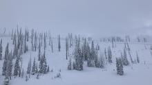
There are 8” of new snow in the Lionhead area, 2” in the Taylor Fork, and no new snow across the rest of the advisory area. Winds are southwest and west at 15-20 mph with gusts of 25-40 mph. Temperatures are in the teens F. Temperatures will rise into the 20s and low 30s F. Winds will continue out of the southwest and west at 15-25 mph with gusts into the 30s mph. Snowfall today and tonight will bring up to 2” of new snow near Big Sky, 3-6” around West Yellowstone and Cooke City, and just a trace around Bozeman.

Yesterday, 3” of snow fell around Big Sky and 1-2” everywhere else. With temperatures in the single digits to low teens F, wind is blowing W-SW at 10-20 mph with gusts of 35 mph. Today will be sunny in the northern ranges and partly cloudy in the south. Mountain temperatures will rise into the high teens and W-SW wind will remain 10-20 mph. By morning the mountains around West Yellowstone and Cooke City could have a trace to 1” of snow.
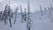
We had crazy weather in the last 24 hours: rain and snow in the northern mountains, snow in the south and winds hitting 105 mph on Lone Peak. 2-3” of dense snow fell around Bozeman and Big Sky and 6-9” fell near West Yellowstone and Cooke City. Wind was W-SW and blew 40-80 mph in most areas yesterday and lessened to 20-40 mph this morning. Mountain temperatures are in the 20s. Today the mountains will get 1-2” of snow, below freezing temperatures and W-SW wind at 15-30 mph.


Winds from the south to southwest are blowing 20-35 mph with temperatures in the 20s F near West Yellowstone and Cooke City and in the 30s F in the mountains near Bozeman and Big Sky. Cooke City got 4” of new snow with an inch near West Yellowstone.
Today, temperatures will be in the 30s F in the northern ranges and in the 20s F in the southern ranges. Winds will blow 25-40 mph from the south to southwest. Precipitation will increase this morning with 10-12” of snow around West Yellowstone, 8-10” near Cooke City, 2-4” in Big Sky and south of Bozeman, and 1-2” in the Bridger Range by tomorrow morning. Precipitation will begin as rain at lower elevations and in the northern portions of the advisory area.