Advisory Archive

In the mountains around Bozeman and Big Sky, 6-10” of snow fell since yesterday morning. Near West Yellowstone and Cooke City, only a trace to 3” fell. Winds are 10-20 mph out of the north and west with gusts of 25-40 mph. Temperatures are in the single digits F. Today will be partly sunny with highs in the teens F. Winds will continue out of the north and west at 10-20 mph. No new snow is expected.


Wow, what a surprise! Since yesterday morning, 8-9” fell in the mountains around Bozeman, 6” in Big Sky and Taylor Fork and 1-2” in Cooke City and West Yellowstone. Wind is blowing west to north at 5-15 mph with gusts of 25-40 mph. Temperatures are in the chilly single digits F. Throughout our forecast area wind will decrease and temperatures will not get much warmer. After a few lingering flurries, today will be a mix of clouds and sun.


Yesterday morning a trace to 1” of snow fell. Winds have calmed from the west to north at 5-15 mph, but in the Bridger Range it is blowing west at 25-39 mph. Mountain temperatures are in the single digits F this morning and will warm to the teens. Today will be snowy with 2-4” in the northern mountains and 1-2” in the southern ranges by tomorrow morning. Ridgetop wind will blow 20-30 mph from the west to north during the storm.

This morning, mountain temperatures are around 10 degrees F with 5 to 10 mph winds from the east to the north. One to three inches of new snow fell across the advisory area. Today, temperatures will be in the upper teens to low 20s F with 5 to 10 mph winds from the north to the west. Light snowfall will return to the area on Wednesday.

Since yesterday morning the mountains received 2-3” of snow from Big Sky to West Yellowstone, 1” near Cooke City, and zero elsewhere. This morning, light snow is falling, temperatures are teens to mid-20s F, and wind is southeast-east at 5-15 mph. In the Bridger Range, east wind is 20 mph with gusts to 35 mph. Today temperatures will be teens to low 20s F with east-northeast wind at 5-20 mph. Light snowfall will continue in most areas with 2-5” possible by tomorrow morning.


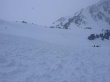
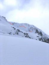
Since yesterday morning 1-2” of snow fell near Cooke City, the southern Madison Range and West Yellowstone with none elsewhere. Yesterday the wind was southerly at 20-30 mph with gusts of 50-65 mph. This morning southerly wind has decreased to 10-20 mph with gusts to 40 mph. Temperatures are teens to high 20s F this morning, and will reach high 20s to low 30s F today. Snowfall is expected in some areas through the day with 4-8” possible near West Yellowstone and the southern Madison Range, 2” near Cooke City and maybe 1” elsewhere.
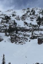
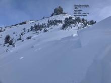
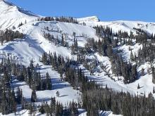
There are 2” inches of new snow in Hyalite, 3-5” in the Bridger Range and around Big Sky, 6-7” near Cooke City and in the Taylor Fork, and 10” at Lionhead. Winds picked up overnight and are now blowing 15-30 mph with gusts up to 50 mph out of the southwest. Temperatures this morning are in the single digits and teens F. High temperatures today will be in the 20s F under cloudy skies. Moderate southwest winds with stronger gusts will continue today. Snowfall will start near West Yellowstone this afternoon with 1-3” possible by tomorrow morning while the rest of the area stays dry. A stronger round of snowfall tomorrow will again favor the southern areas.
One inch of new snow fell around West Yellowstone yesterday, while the rest of the area remained dry. Temperatures this morning are in the single digits to mid-teens F with 10 to 25 mph winds from the south and west gusting 35-45 mph. Today, temperatures will rise to the upper teens to mid 20s F with moderate south and west winds continuing. Snowfall will begin this morning with 1-3 inches falling around Bozeman and 2-4 inches across the rest of the advisory area by this evening. Another round of snow is forecast to start tomorrow afternoon, again favoring the southern areas.


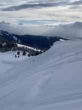
This morning, temperatures are in the single digits to mid-teens F with 5 to 15 mph winds from the west to southwest and there is no new snow. Today, temperatures will rise to the upper teens to mid-20s F with 5 to 15 mph winds from the south to the southwest. A small storm favoring the mountains near West Yellowstone will pass through tomorrow, with more snow arriving later this weekend.


This morning, mountain temperatures are in the teens F with 20-30 mph winds from the west to southwest. Cooke City received 3” of snow in the last 24 hours with 1” near West Yellowstone. Today, the high temperatures will be in the upper teens F, winds will drop off midday to 5 to 15 mph from the south to southwest and there will be no new snow.