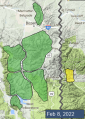
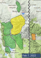
Advisory Archive

This morning there is no new snow. Temperatures are high teens to mid-20s F, and wind has been west-northwest at 10-20 mph with gusts of 25-40 mph. Today will be mostly sunny with temperatures reaching mid-20s to high 30s F and west wind at 10-20 mph with gusts to 30 mph. Clouds will increase tonight with the next round of snow on track for late tomorrow evening.


Snowfall yesterday brought 2” to the Bridger Range, 1” near Cooke City, and no new snow in the rest of the advisory area. Temperatures this morning are in the teens F with moderate west and northwest winds. Temperatures today will rise into the high 20s and 30s F under mostly sunny skies. Moderate west and northwest winds will continue. The next chance for snowfall is Monday night.


There is an inch of new snow at Lionhead this morning with no new snow elsewhere. Winds have been blowing 15-25 mph out of the northwest and west with gusts of 40-60 mph. Winds will diminish slightly this morning to 15-20 mph with gusts to 30. Temperatures are in the teens and 20s F this morning and will only rise a few degrees today. A trace to an inch of snow is possible this morning across most of the area, before clouds clear and skies become mostly sunny. There is a chance that Cooke City could see up to 4 inches fall today.


Big Sky is reporting 1-2” of new snow along with an inch in Hyalite and Cooke City. Everywhere else either got missed or received a dusting. Wind remains steady from the W-N averaging 10-20 mph with gusts of 35 mph and 53 mph on the Bridger ridge. Under partly cloudy skies, mountain temperatures are in the mid 20s and will reach above freezing today. Clouds will stream in later today but snowfall will only be a trace to 1” overnight. :(


This morning there is no new snow. Under cloudy skies mountain temperatures are near 20F with west to northwest wind averaging 10-20 mph and gusting to 35 mph. The Bridger Range is windier with gusts hitting 50 mph. Scattered snowfall will begin later this morning and continue into tonight. Wind will remain a similar speed and mountain temperatures will rise to near freezing. By tomorrow morning the mountains will have 1-2” of snow.

This morning, temperatures are in the teens F and the wind is blowing 15-25 mph from the west to northwest. There is no new snow. Today, high temperatures will be in the upper 20s to mid 30s F with 10-25 mph winds from the west to southwest. Snowfall beginning late tonight will bring 2-4” to the Big Sky and Hyalite areas and a trace to 2” everywhere else by tomorrow morning.


There is no new snow this morning. Temperatures are in the low teens to low 20s F and winds are blowing 10-25 mph from the west. Today, temperatures will be 30-40 degrees F with strong winds focused around Bozeman, Big Sky and Cooke City blowing 15-30 mph from the west to southwest. Light snow will return to the area tomorrow morning.


Since yesterday morning the mountains got 7” of snow near Cooke City, 4” in Hyalite, 1-2” near West Yellowstone, and a trace to 1” in the Bridger Range and Big Sky. Yesterday, northwest wind was 20-30 mph with gusts to 55 mph. This morning, wind has decreased to 5-15 mph with gusts to 25 mph, and temperatures are single digits to teens F. Today, skies will be mostly clear with temperatures reaching 20s to low 30s F, and west-northwest wind will average 5-15 mph with gusts to 25 mph. No snow is expected for a few days.


Three inches of snow fell last night near Cooke City with one inch near West Yellowstone, while the mountains around Bozeman and Big Sky stayed dry. Temperatures this morning are in the teens and 20s F. Westerly winds are at 20-30 mph with gusts of 35-55 mph, except for around Cooke City where they only 10 mph with gusts of 25 mph. Moderate west winds will continue today with gusts backing off a bit. A trace to an inch of snow will fall across most of the advisory area today with 1-2” accumulating by tomorrow morning. Around Cooke City 4-6” of new snow will fall today with 6-8” by tomorrow morning.
There is no new snow this morning. Temperatures are in the single digits and teens F. Winds are 15-25 mph out of the west and northwest with gusts of 35-45 mph. These winds will continue today as temperatures climb into the 30s F in the north and only into the teens F in the south. Today will be mostly sunny except around West Yellowstone where clouds will linger. A dusting of snow is possible tonight.
