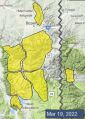
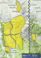
Advisory Archive

Mountain temperatures dropped below freezing overnight and are in the 20s F early this morning. There is no new snow. Winds are 5-10 mph out of the west to northwest with gusts to 20 mph. Skies are partly cloudy this morning. There will be a mix of sun and clouds today. Westerly winds will be 5-15 mph with gusts to 30 mph. Temperatures will rise into the 40s F this afternoon and maybe even reach the 50s F at lower elevations. Temperatures this weekend are forecast to be even higher.


At 5 a.m. skies are partly cloudy, wind is west to southwest averaging 15-20 mph with gusts of 40 mph. Mountain temperatures are slightly above freezing in the Bridger Range at 9,000’ and barely below freezing elsewhere. Today will be sunny and westerly wind will blow 15-30 mph at the ridgetop. Temperatures are expected to rise into the low to mid 40s F. Cooke City will remain partly cloudy and could even get a trace of new snow.


At 5 a.m. skies are mostly clear with westerly wind averaging 10-15 mph and gusting to 30 mph (25-38 mph in the Bridger Range). Freezing level is around 7,000’ and temperatures at 9,000’ are in the mid 20s F. Today will be sunny, wind will be light and mountain temperatures will reach the mid 40s as the freezing level rises to 10,000’ before dropping again tonight. Shorts and flip-flop sightings will increase today along with sunburn potential.


This morning, temperatures are in the teens F with 5-20 mph winds from the west to northwest. The Bridger Range received a trace of new snow overnight. Today, highs will be in the 30s F with 5-15 mph winds from the west to northwest and skies will clear. The next chance for significant precipitation is early next week.


This morning, mountain temperatures are in the single digits above and below zero degrees F with 5-15 mph winds from the west to northwest. The mountains around Bozeman and Big Sky received 3-5” of new snow in the last 24 hours and the mountains near West Yellowstone and Cooke City received 1-2”. Today, temperatures will rise to the upper 20s to mid 30s F with 5-15 mph winds from the west to southwest. Some areas may get a trace of snow tonight.
This morning it is snowing! Near Bozeman and Big Sky have 2-5”, there is an inch near West Yellowstone, and near Cooke City snow started after 6am with a trace so far. Temperatures are 20s to low 30s F and moderate southwest winds have decreased to 10-20 mph. Temperatures will be 20s F and drop to teens F this evening, and wind will shift to northwest and increase to 15-30 mph this afternoon. Snow will continue through mid-day. By this afternoon 3-5” are likely throughout the forecast area with 6-8” possible in some areas.


Yesterday morning a trace to an inch of snow fell near Big Sky and Cooke City. Temperatures reached 30-39 F yesterday, and this morning they are high 20s to low 30s F. Wind has been southwest to west at 5-20 mph with gusts of 25-35 mph. Today temperatures will reach high 30s to low 40s F under increasing clouds. Southwest wind will increase to 15-30 mph and snow is expected tonight and tomorrow ahead of a cold front. By tomorrow morning the mountains from Bozeman to West Yellowstone could get 2-3” with an inch near Cooke City, and by tomorrow afternoon another 3-5” are possible throughout the forecast area.


There is no new snow this morning. Temperatures are in the teens and low 20s F. Winds are 5-15 mph out of the south and west, with gusts up to 30 mph. There will be a few snow flurries this morning, before clouds clear and it becomes partly sunny this afternoon. High temperatures will range from the high 20s up to 40 F. Moderate southwesterly winds will continue today. The next chance for significant snowfall is on Sunday.


Before the storm ended yesterday another 1-3” fell in the mountains, except West Yellowstone. Wind decreased overnight and is averaging 5-15 mph out of the west with gusts of 28 mph (NE at Lionhead). Skies will be mostly sunny today and temperatures will rise from this morning's low of 10-15 F into the mid-30s with light westerly wind. No snow is expected until Sunday.
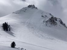
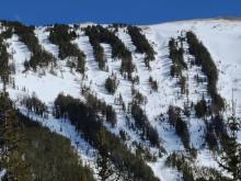
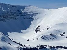
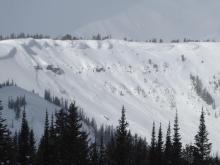
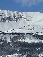
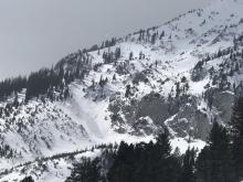
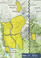
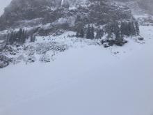
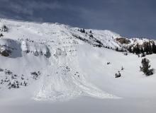
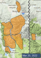
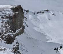
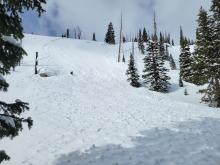
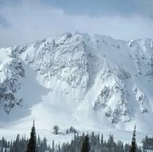
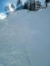
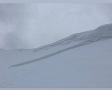
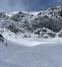
WET SNOW AVALANCHE DANGER: With today’s mountain temperatures forecasted to be above freezing, shallow, wet loose avalanches may be numerous on slopes getting sunshine.
In the last 24 hours the Bridger Range picked up 6” of dense snow while the rest of our forecast area received 3-5”. Wind is blowing westerly at 10-15 mph with gusts of 35 mph under mostly cloudy skies. Mountain temperatures are in the low to mid 20s F. Pulses of snow showers will continue today and drop another inch by this evening. Wind will be 10-20 mph out of the west as temperatures rise into the high 20s this afternoon. Skies will clear tonight.