Advisory Archive

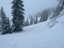
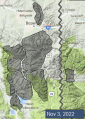
In the last 24 hours the mountains around West Yellowstone and Cooke City received 10” of snow, and it’s still snowing. Areas around Big Sky, Hyalite and the Bridger Range got 2-3”. Wind is averaging 15-30 mph with gusts hitting 50. It is blowing out of the SE in the Bridger Range and SW-W everywhere else. Today, expect another inch or two in the northern areas and 6” in the southern mountains. Winds will remain strong with temperatures in the 20s F. A little snowfall Sunday night will turn into a snowstorm on Monday. Stay tuned, and in the meantime put fresh batteries in your beacon, test your airbag and dust off your helmet. Winter’s footsteps are getting louder.
Winter returned yesterday after a mild week. The mountains near Big Sky and Bozeman received 4-7” of snow with 1-3” near West Yellowstone and Cooke City. Winds are 5-15 mph from the west to northwest and temperatures are in the teens F. Lingering snow showers will exit the area this morning and winds be 5-10 mph from the north to the west with temperatures in the teens to 20s F. Another storm arrives on Friday with a snowy and cool week projected.
For current weather data, check our weather stations in Cooke City, Hyalite, Lionhead and on Sawtelle Peak near Island Park, ID. Also, utilize the ski area weather stations from the Yellowstone Club, Big Sky and Bridger Bowl, and SNOTEL sites throughout our advisory area. We will also update the Weather and Avalanche Log daily throughout the fall.

After the big storm last weekend, snowfall tapered off on Monday night leaving an additional couple inches near West Yellowstone and Cooke City. Through the rest of the week there were occasional flurries without substantial accumulation. High temperatures in the mountains have been right around freezing. The coming days will bring continued cool, dry conditions and moderate winds, with perhaps a bit more sun than this past week. The next chance for snow isn’t until the middle of next week.
For current weather data, check our weather stations in Cooke City, Hyalite, Lionhead and on Sawtelle Peak near Island Park, ID. Also, utilize the ski area weather stations from Big Sky, Bridger Bowl and Yellowstone Club, and SNOTEL sites throughout our advisory area. We will also update the Weather and Avalanche Log daily throughout the fall..

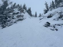
This weekend, rain turned to snow across the advisory area and the ranges near Bozeman and Big Sky received 20-30” of new snow and 10” near West Yellowstone and Cooke City. The first half of the week will bring 20-35 MPH winds from the northwest to the southwest. The Cooke City and West Yellowstone areas will get 3-7” of snow by Thursday morning with lighter accumulation in the mountains near Bozeman and Big Sky. Mountain temperatures will remain in the 20s to mid-30s F through the week.
For current weather data, check our weather stations in Cooke City, Hyalite, Lionhead and on Sawtelle Peak near Island Park, ID. Also, utilize the ski area weather stations from Big Sky, Bridger Bowl and Yellowstone Club, and SNOTEL sites throughout our advisory area. We will update the Weather and Avalanche Log daily and issue pre-season bulletins as needed.

Well, that was a fast transition - welcome to winter! Rain switched to snow on Friday night and has piled up across the advisory area. Snowfall totals range from just a couple inches at lower elevations up to 1.5-2 ft at SNOTEL sites (7000-9000 ft) and likely even deeper at higher elevations. Snow water equivalent totals range from 1.7” in the Bridger Range and Cooke City up to 3.4” in Taylor Fork (see the Weather and Avalanche Log for specifics). Snowfall will continue today, favoring the Big Sky area with up to another foot falling by tomorrow morning. Temperatures will stay cool with chances for snowfall continuing through mid-week.

Change is coming. The beautiful fall weather we’ve been basking in is coming to an end. A pattern shift will occur this weekend. Expect colors in the mountains to shift from green and gold to white. For current weather data check our weather stations in Cooke City, Hyalite, Lionhead and our new station on Sawtelle Peak near Island Park, ID., as well as Bridger Bowl’s weather stations, and SNOTEL sites throughout our advisory area. As snow begins to fall we’ll update the Weather and Avalanche Log daily and issue pre-season bulletins as needed.

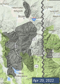
Spring weather can be highly variable and create a mix of avalanche problems to watch for. Snow conditions and snow stability can change drastically from day to day or hour to hour. Anticipate rapid change and plan accordingly. Plenty of snowfall over the winter with more spring snow to come makes avalanches possible into summer.
Unsettled weather beginning Wednesday brought a couple inches of snow to the mountains around Bozeman and Big Sky, with 5-10” near West Yellowstone and Cooke City. At lower elevations this precipitation fell as rain. Heavy snowfall is expected today around Bozeman and Big Sky with 4-8” falling by the end of the day. Only an inch or two will fall around West Yellowstone and Cooke City. Tomorrow will be sunny with temperatures above freezing. Sunday will be cloudy again with a sprinkling of snow possible.


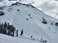
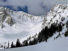
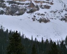

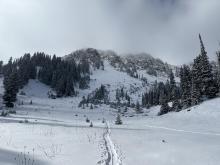
Between Thursday night and Sunday morning, a large spring storm left 1-2 ft of fresh snow across most of the advisory area (Lionhead only received a few inches). The storm system moved out yesterday, with skies clearing and temperatures rising above freezing. Today will be mostly sunny with mountain temperatures in the 40s and 50s F. Clouds will move in for most of the rest of the week, but there will also be sunny periods mixed in. High temperatures will be in the 40s F. There are chances for light precipitation starting on Wednesday, but it won’t amount to more than a few inches of snow.