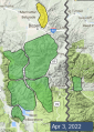
Advisory Archive
This morning there is no new snow. Temperatures are high teens to low 30s F. Wind is southwest at 10-20 mph with gusts of 30-40 mph. Today, wind out of the west-southwest will increase to 20-30 mph with gusts of 40-50 mph, temperatures will reach mid to high 30s F under mostly cloudy skies, and snow is expected this afternoon and tonight. By tomorrow morning, 3-5” of snow could fall through most of the forecast area with 7-10” near Cooke City, and a couple more inches during the day tomorrow.


This morning the mountains have 4” of new snow in the Bridger Range, 2-3” near Big Sky and Hyalite, 1” near Cooke City and zero near West Yellowstone. Temperatures are low teens to mid-20s F and wind has been west-northwest at 15-25 mph with gusts reaching 40-60 mph overnight. Today will be mostly sunny with westerly wind at 10-25 mph and temperatures reaching mid-30s to low 40s F. The next chance for snow is tomorrow afternoon.


There is no new snow this morning. Temperatures are in the 20s F with 10-20 mph winds out of the west and southwest. Temperatures will rise into the 30s and low 40s F with increasing southwest winds. There will be a mix of sun and clouds before showers move in this afternoon. There may be a sprinkle of rain at lower elevations before it switches over to snow. 1-2” of new snow are possible by this evening with an additional dusting tonight.

There are 5” of new snow around Cooke City with 1-3” near Bozeman, Big Sky, and West Yellowstone. Temperatures are in the teens F. Winds are 10-15 mph from the west and northwest with gusts to 30 mph. Similar winds will continue today, shifting slightly southwest this afternoon. Temperatures will rise into the high 20s and 30s F. Skies will be mostly sunny this morning with increasing clouds this afternoon. Snow showers are expected tomorrow.

At 6 a.m. light snowfall has dropped a trace to 1” of snow in the mountains. Temperatures are in the mid 20’s F and ridgetop wind is 5-15 mph with gusts of 20-30 mph from the southwest to northwest. Today will be cloudy with scattered snowfall measuring 1-3” by tomorrow morning. Temperatures will rise to the mid-30s F and wind will continue to be light to moderate from the west-southwest.


Temperatures this morning are in the teens to low 20s F with 10-20 mph winds from the west to northwest. Yesterday morning the mountains around Bozeman, Big Sky and Cooke City got 1-3” of snow. Today, temperatures will be in the 40s F under sunny skies. Winds will be 5-10 mph from the southwest to the northwest and the mountains will get a trace of snow tonight.


Freezing levels are around 8000’ elevation this morning, with temperatures above this level ranging from the upper 20s to low 30s F. Winds are 5-10 mph from the west to northwest and the mountains around Bozeman and Big Sky received 1” of new snow this morning. Today, temperatures will be in the low to mid 30s F with northwest winds blowing 5-15 mph. The mountains around Bozeman and Big Sky will get 1-2” of snow this morning with a trace to 1” elsewhere.


Yesterday temperatures reached mid-40s to high 50s F, and this morning temperatures are high 30s to low 40s F. Wind has been southwest at 5-20 mph with gusts of 25-50 mph. Today will be partly sunny with increasing clouds and southwest wind increasing to 15-25 mph this afternoon. Temperatures will reach high 40s to mid-50s F. Tonight, a cold front will bring cooler temperatures and a few inches of snow during the day tomorrow.


Yesterday, temperatures reached high 30s to low 50s F, and wind was from the southwest-west at 10-20 mph with gusts of 30-40 mph. Overnight, temperatures remained above freezing at elevations below 10,000 feet. This morning temperatures are 30-40 F and wind is 5-15 mph out of the west-southwest. Today the wind will remain light, skies will be mostly clear, and temperatures will reach 40s to mid-50s F, nearing 60 F in the mountains near Bozeman and Big Sky.


Mountain temperatures early this morning are in the 30s F - mostly above freezing. Winds are 10-20 mph out of the west with gusts of 30-40 mph. Clouds will clear this morning and today will be mostly sunny. Moderate west winds will continue. High temperatures will be in the 40s F and potentially low 50s F. Tomorrow is forecast to be even warmer.