Advisory Archive
This morning temps range from the upper 20’s to low 30’s F under mostly clear skies. Winds are blowing 10-20 mph out of the east-southeast in the northern mountains and 10-20 mph out of the north-northeast in the south. Today, temps will warm into the upper 30’s to mid-40’s F and winds will shift to the southwest blowing 20-30 mph. Skies will become partly to mostly cloudy by this afternoon. Increasing precipitation tonight will drop 1-2” of snow in the southern mountains by tomorrow morning.


If you liked yesterday, you’ll like today: sunny skies, mountain temperatures in the 50’s and winds out of the east to southeast at 10-20 mph. This morning mountain temperatures are a few degrees below freezing except in the Bridger Range and Hyalite where an inversion has ridgetop temperatures in the low to mid 30’s. Tomorrow looks to be sunny, but snow and rain are expected this weekend.
Under clear skies mountain temperatures dropped to the high 20s last night after reaching the mid-40s yesterday. Winds are easterly at 5-10 mph. Today will be sunny with light southeast wind. Mountain temperatures are forecasted to break 50F for the first time this season.

Skies are clear and there is no new snow. Temperatures are in the teens F to mid-twenties and winds are 10-20 mph out of the north and west, with gusts up to 30 mph. Today, skies remain clear and temperatures warm into the mid to upper 30’s F. Winds will stay light to moderate out of the north and west. High pressure continues through the week. The next chance for snow is this weekend.


This morning temperatures are teens to mid-20s F under clear skies. There is no new snow. Wind is northerly at 5-15 mph, and near Cooke City wind is out of the east. Today temperatures will reach the mid to high 30s F under clear skies. Wind will be northwest to northeast at 5-15 mph. Expect similar clear and dry weather through tomorrow and warmer temperatures later in the week.


This morning the mountains have no new snow. Temperatures are teens to low 20s F and wind is westerly at 5-15 mph. Today temperatures will reach mid to upper 30s F under mostly sunny skies. Wind will be west-northwest at 5-15 mph. For the next week expect clear skies with daily high temperatures steadily rising through the week

This morning there’s no new snow to report and skies are mostly clear. Temps are in the teens F and winds are blowing 10-20 mph out of the west. Today, skies remain clear and temps warm into the mid to upper 30’s F. Winds will stay light to moderate out of the west. Warm and dry weather continues through the weekend.
The Bridger Range picked up 2-3” of snow over the past 24 hours while rest of the forecast area received a trace to 1”. This morning temps are in the single digits to low teens F under partly cloudy skies. Winds are blowing 10-30 mph out of the west-southwest. Today, highs warm into the upper 20’s to low 30’s F and winds will continue to blow 15-30 mph out of the west-southwest. Skies remain partly cloudy today and no snow is expected through the foreseeable future.
Yesterday, 6” of snow fell in Hyalite and 1” around Big Sky. Winds are 10-20 mph out of the north except around Bozeman where they are 10-15 mph from the west. This morning skies are cloudy and mountain temperatures are near 10F. By afternoon skies will clear and temperatures will rise above freezing. Clear, sunny weather is the only item on the menu for the next 7 days so stock up on SPF 50 sunscreen.
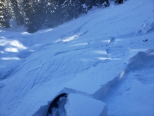
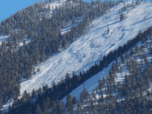
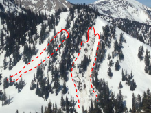
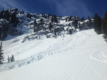
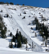
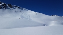
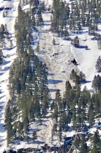
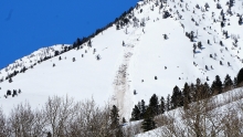
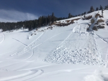
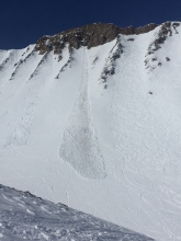
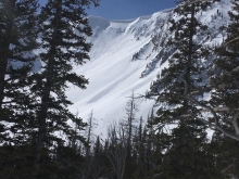
WET AVALANCHES
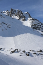
Sun and above freezing temperatures makes wet avalanches. If skies clear this afternoon wet loose avalanches will occur on slopes getting direct sunshine.


At 5 a.m. under cloudy skies there is no new snow. Mountain temperatures are in the teens F and winds are 10-15 mph from the north to northeast. Snow showers today will drop 1-3 inches with light northerly winds. Temperatures will reach the upper 20s this afternoon under cloudy skies.